
0
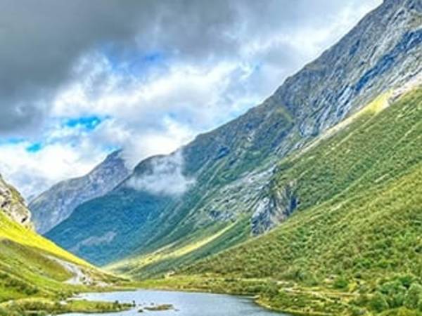
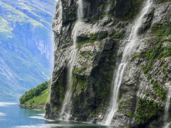
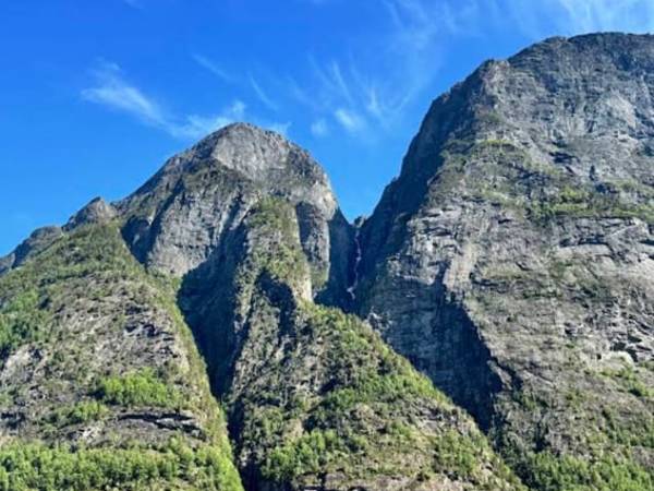
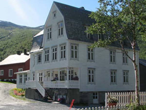
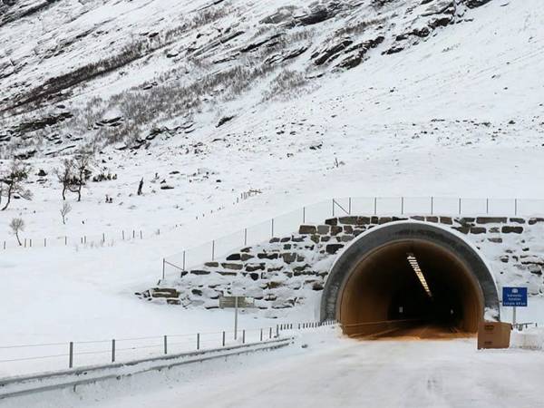
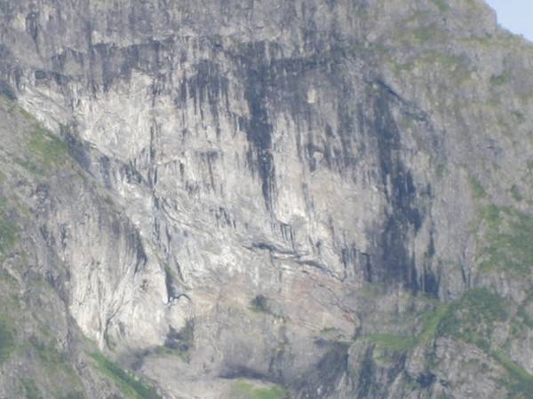
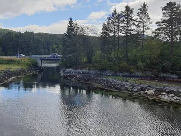
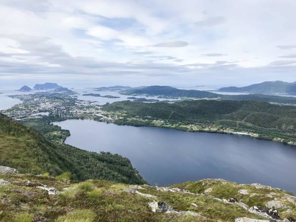
Experience everything about the Norwegian fjords in one day. Enjoy boat trips from Ålesund through the Hjørundfjord and Geirangerfjord, fascinating bus journeys across Nordangsdalen with its rich history from the Viking Age to the golden age of tourism, the Eagle Road, sightseeing stops in Hellesylt and Geiranger, and taste the water from the Bridal Veil waterfall. End the day at the Kokarsteinen viewpoint before returning to Ålesund – all in one unforgettable tour! Click “DOWNLOAD” and then “START” to begin your experience. Press the language button to choose between our 14 available languages. Highlights along the way: Hjørundfjord Øye Nordangsdalen Lygnstøylvatnet – where an entire village lies beneath the water Villa Norangsdal Hellesylt Geirangerfjord The waterfalls Geiranger Eagle Road Eidsdal Storfjord Linge Kokarsteinen Ålesund Tickets and info: https://www.cruise-service.no/

To the northwest, we now pass Urke and the small village of Maude, while the Stenes farm barely peeks out on the other side of the fjord. Here, in the heart of the Sunnmøre Alps, the villages cling closely to both the fjord and the steep, barren mountains. Urke is one of those small villages with a strong sense of community. A few dozen residents keep the place alive, and here we find what may be Norway’s most charming shop—Urke Landhandel. The store was saved from closure by local enthusiasts and now serves as a shop, meeting place, and historical museum. Here, you can buy everything from locally cured meats to homemade juice—and maybe a good story as a bonus. The fjord has always been both a source of food and a travel route, and the rugged mountains likewise. The steep slopes are difficult to traverse but provide both grazing land and shelter. In the summer, the mountain pastures fill with sheep and the bustle of farm life. In autumn and winter, however, the polar night, storms, ice, and meters of snow could be demanding for both man and beast. Can you imagine living here year-round, experiencing the contrasts between romantic, warm sunsets and calm seas, and icy storms with roaring rivers and waterfalls?

At the fjord's edge, valleys, rivers and fjord converge, and in the heart of this beautiful idyll lies Hellesylt - a small village with great appeal. Each summer, tourists flock here to experience the dramatic landscape, waterfalls, and not least, the ferry continuing into Geiranger. Right in the center, the Hellesyltfossen waterfall plunges through the village - a spectacular sight and photo opportunity, especially during snowmelt. Simultaneously, Hellesylt serves as an important transportation hub with road connections to Stranda, Ørsta and Stryn. The location is also known for the Hellesyltdagane cultural festival and as a popular starting point for mountain hikes in the area.

Lyngstølvannet, located here in Norangsdalen, is a captivating lake formed by a rockslide in 1908. The submerged remains of a farm can still be seen underwater, creating an eerie yet beautiful sight. This unique underwater forest, along with the stunning surrounding scenery, makes Lyngstølvannet a popular destination for visitors and photographers.

The boat is now passing the point where Geirangerfjord meets Synnulvsfjord. The latter continues further into Storfjorden, which in turn extends all the way to the beautiful Sunnmøre coast and the Jugendbyen of Ålesund. If you look North, you will be able to catch a glimpse of Åkernesremna, which has turned these village communities along the fjords upside down. Because, on the mountainside over Åkerneset there is a large part of the mountain that is in danger of breaking away. A landslide here would, in just a few minutes cause Hellesylt, Geiranger and other small villages along the way to be hit by waves of up to 40 metres high. The local community have learned to live with the danger that is literally hanging over them. Today there is a warning system, that is so good that a landslide would be detected well in advance giving the villagers time to evacuate. However, this was not the case in the well know Norwegian disaster movie ‘the wave’ in which the warning system didn’t work as it should and the subsequent landslide caused monster waves that reached all the way up to the Hotel Union in Geiranger.

Before us stands Hotel Union Øye, one of Norway's most historic hotels. Opened in 1891, it quickly became a popular destination for European aristocracy and mountain enthusiasts. Among its famous guests were Emperor Wilhelm II and Karen Blixen. Many rooms are named after historical figures, and the hotel is renowned for its mysterious atmosphere. You may have heard of the "Ghost Queen" in room number 7 - said to have died of a broken heart. Guests have reported doors opening by themselves and cold drafts outside the room, though there's surely a natural explanation. The hotel features additional rooms in converted surrounding houses and an exquisite garden perfect for relaxation and contemplation. This is where those seeking quality, tranquility and beautiful nature come to stay.

Have you heard about "Friaren", the suitor who laid his sights on seven wild unmarried sisters, only to have his offers turned down by each and every one of them? Many believe that he became so depressed that he turned to the bottle and sought shelter in the waterfalls on the mountainside that we are now passing, and that is why according to local legend the waterfall has its characteristic bottle shape. On the opposite side of the fjord, you can see one of Norway’s most photographed landmarks, the characteristic "sju søstre", or the Seven Sisters, waterfalls. From a distance, they look like the hair of seven women, hence the name. The waterfalls are an impressive sight, especially when the snowmelt is big and constantly feeding the waterfalls which on average are in free fall for an incredible 250 metres. And believe it or not, on a small mountain shelf, nearly right at the top of the seven sisters, is the abandoned and landslide prone farm of Knivsflå. It is a very popular tourist destination with its fantastic and spectacular view over Geiranger fjord, where at the same time you can get a feel for its unique history and how it must have been to live there in times gone by.

We are now passing the tip of Slinningsodden, at the far end of the island of Hessa, right between Ålesund town centre and Langevåg. This is the site of one of Norway’s most spectacular Midsummer bonfires – in fact, the tallest in the world. Each year, local youths and volunteers gather to build a towering wooden structure, often exceeding 40 metres in height. In 2016, they set a world record with a staggering 47.4-metre bonfire! When it's lit on Midsummer’s Eve, the fjord fills with boats and spectators drawn to the heat, the glow, and the magic of the flames. This is more than a bonfire – it’s a living tradition, a symbol of community spirit and pride.

Here at Lekneset, two fjords meet—Hjørundfjorden and its arm, Norangsfjorden—creating a dramatic and beautiful landscape surrounded by the mighty Sunnmøre Alps. The 35-kilometer-long Hjørundfjorden ends at the small village of Bjørke, nestled deep in the fjord. Norangsfjorden, on the other hand, is short and narrow, only a few kilometers long, but it leads inland to the village of Øye, where towering mountains rise steeply on both sides. From Lekneset, there is a ferry connection to Sæbø on the other side of the fjord. You can also follow the road along the fjord to Urke and Øye, and further over the mountains to Hellesylt or Stranda—a spectacular drive through Norangsdalen, one of Norway’s most dramatic valleys. Looking out over the fjord from here, you’ll understand why many say this is among the most beautiful scenery Norway has to offer—where drama, tranquility, and grandeur all come together in a single view.

Welcome aboard! You're about to experience one of Norway’s most breathtaking fjord journeys, from the vibrant town of Ålesund, through narrow straits and wide fjords, all the way to the charming village of Øye at the end of the majestic Hjørundfjord. As we cruise through Borgundfjorden and glide past coastal islands, you’ll hear stories of Viking battles, dramatic shipwrecks, and local legends. We'll pass through the slender Vegsundet strait before entering the vast Storfjorden, framed by towering peaks and deep blue waters. Then we turn into Hjørundfjorden — a hidden gem surrounded by the wild Sunnmøre Alps, where steep mountains plunge straight into the sea. So sit back, relax, and let the landscapes and stories unfold as we guide you on this unforgettable voyage through the heart of Norway’s fjord country.

Perhaps you are wondering why people settled in these impassable places? It sounds a little bit strange, but in Norway there was in fact a lack of space from the 1500s onwards. During that time, Geiranger was so populated that people could not find houses or land. The solution was for people to move to where they could be self-sufficient, often with their closest family. Therefore, we often see settlements along most of the green lungs of the fjord and farms right up the valley sides. The alternative was either to move further inland or out towards the coast. Inland there was not much fishing and along the coast not much of an opportunity for hunting, but here in the fjords there were both. Life along the fjord and up the sides of the valley, of course offered challenges, but also had many high points. Every Christmas the dark fjord was full of rowing boats on their way to Geiranger with lanterns on their sterns. This must have been a beautiful and ceremonious sight. On these farms they lived at one with nature for many generations, but gradually the life became too hard and from the beginning of the 1900s the emigration began. Today, most of the farms are in use as weekend homes or are rented out to tourists.

We now drive into the 377-meter-long tunnel, Hellesyltporten, as serves as a gateway to breathtaking fjords and natural wonders. Hellesylt itself is known for its picturesque scenery, with quaint houses and lush landscapes. One of the main attractions we will pass on the upper side of the tunell, is Hellesyltfossen, a powerful waterfall that cascades through the village, creating a stunning and dramatic view.

Now the fjord opens up towards Sæbø, the largest village in Hjørundfjorden and a natural hub for trade, education, daily life, and transportation. Here, fjord and mountains meet at their most magnificent, with Skårasalen, Saksa, and Slogen forming a dramatic backdrop. For hundreds of years, Sæbø has been the center of the fjord communities. It was once a trading post, mail stop, and steamship dock, and even today, it still has a grocery store, school, gas station, and ferry terminal. Ferries run to Urke and Lekneset, and Sæbø remains a vital link between the many villages around the fjord. In summer, the place fills with boat tourists, mountain hikers, and travelers passing through. But for the locals, it's everyday life that matters—schoolchildren at the dock, cows grazing on the slopes, fishermen hauling traps and nets, and community gatherings at the village hall. Along the shoreline, there’s a small swimming beach and several places to stay, and you can rent both boats and bicycles. Many use Sæbø as a base for mountain hikes—with marked trails leading straight from the village to some of the Sunnmøre Alps' most stunning peaks.

For around two weeks every year, a very special phenomenon occurs right where we are passing now. Melt water from the high Sunnmøre Mountains reaches its climax here when the water rushes down the mountain and creates what is known as the bridal veil. The waterfall of the same name then produces a beautiful fine spray, which together with the wind fans the water across the mountain road like a beautiful transparent bridal veil. If the sun is shining it creates an incredibly beautiful rainbow effect, which gets the tourists’ cameras clicking. There are seven other places in Norway that have waterfalls called the Bridal Veil, but this is the most famous and is ranked amongst the 50 biggest waterfalls in Norway. Directly above and next to the famous waterfall the mountain farms Megardsplassen and Horvadrag hang on two narrow ledges almost 500 metres above sea level. The last tenants left the farm in 1900, but considered moving back the year after, but by then an avalanche had taken all the houses and washed them into the fjord. Had they still been living there; they too would have followed their house down to the bottom of the fjord.

Norangsdalen has long been used for summer pasturing and mountain dairy farming. We will soon pass Stavbergsetra, where the houses, or "sela" as they are called here in Norway, are placed against large rocks in a scree, to shelter them as much as possible from avalanches and wind. The mountain dairies were built in the mid-1800s when dairy farming was at its most intensive in the country. From the 1920s, dairy farming in Norangsdalen declined, and by the 1950s, it had almost completely ceased. Today, cattle and sheep graze in the valley.

We're now driving through Øye, a small village that over a century ago was a bustling meeting place. The dramatic landscape attracted adventure tourists as early as the 1800s - English salmon anglers, German emperors and Norwegian artists arrived by tourist ships. Soon hotels and guesthouses were built, with up to four accommodations operating at its peak. Tourism transformed the local community: farmers became transporters, dairymaids turned into waitresses, and many encountered foreign languages and customs for the first time. This was a pivotal era - not just for Øye, but for all of Norway. This small village played a significant role in shaping modern Norwegian tourism.

What do the Suitor "Friaren, The seven sisters, "De sju søstre" and The devil’s column, "Helvetesgjølet", have in common? They are of course all tourist attractions along the Geiranger fjord. But in addition, they are also three tasty beers in the range of beers produced by the Geiranger brewery. The tourist village has a long tradition of beer brewing. All the farms had their own beer that was brewed for Christmas, often leading to a dispute over who had brewed the best beer. Therefore, a particularly serious competition was arranged at the Hotel Union where impartial people with a good palette for beer judged the beer of the year. The winner was crowned ‘Beer King of Geiranger’ a title up there with other prominent awards. The Geiranger brewery has developed these traditions further and produces exciting new beers that are available in supermarkets, outlets, and restaurants around the country.

You may be wondering what life was like here in earlier times. In Geiranger, life was demanding, dramatic, and beautiful all at once. People lived close to nature, clinging to the steep mountainsides and relying on whatever the landscape could provide. Everything was transported by boat — food, hay, livestock, and people. During winter, the village could be cut off for weeks, and families had to manage with what they already had. Still, the people here were proud, and the sense of community was strong. If you look up toward the steep mountain walls, you’ll see some of Norway’s most remarkable mountain farms. Skageflå, Knivsflå, and Blomberg were built on narrow ledges high above the fjord, where families kept cows and goats and cut hay on the steep slopes. Reaching them often meant climbing by rope and ladder, and children were sometimes tied for safety. Today, Skageflå can be reached on foot, but it is hard to imagine what it must have been like to live there year-round — through storms, snow, and long stretches of silence. These farms tell a powerful story of courage, endurance, and the ability to adapt to the forces of nature.

Now we approach Trandal, a small village with no road access but an undeniable charm. Nestled in the heart of Hjørundfjorden, you’ll find Christian Gaard Bygdetun—a hidden gem that uniquely blends history, nature, and hospitality. What began as a small farmstead with goats, chickens, and cows has evolved into a gathering place for both locals and visitors. Its founder, Frank Storeide, was known for his creativity and out-of-the-box thinking, leaving a lasting mark on the place. Today, the farm is run by his family, who carry on the legacy with warmth and enthusiasm. Christian Gaard is not only famous for its rustic charm and breathtaking views but also for its music festivals—TrandalBlues, TrandalRock, and Trandal Countryfestival. These events draw music lovers from across the country, offering an experience unlike any other. To get here, you’ll need to take a boat—adding to the sense of arriving somewhere truly special. Once ashore, you can enjoy local food, stay in cozy cabins, and perhaps take a swing in the iconic fjord-side rope swing. Trandal and Christian Gaard Bygdetun offer an experience where nature, culture, and community come together—a place where time stands still, and memories last a lifetime.

Ålesund is a modern and versatile city, known for its architecture, bustling port, and deep connection to the sea. As we approach the city centre, you’re looking at a place shaped by both catastrophe and innovation. Before the great fire of 1904, Ålesund was a thriving fishing town, with cod and clipfish as its main exports. Then came the night that changed everything – a single spark, strong winds, and by morning, nearly the entire town lay in ruins. The rebuilding became a national effort. Young architects, inspired by the Art Nouveau movement, redesigned the city using stone and brick instead of wood. The result is what you see today – towers, spires, and curved facades in a unified, elegant style. Today, Ålesund is a global hub for fishing, seafood, maritime technology, and innovation. The city exports everything from salmon to cutting-edge ship design and aquaculture systems. With top-level education and research institutions, Ålesund is now a centre for sustainable development – set in one of the most stunning coastal landscapes in the world.

Heading into Ålesund, we now see Volsdalsberga – a beautiful recreational area with smooth coastal rocks, a bathing spot, and green spaces that stretch all the way down to the fjord. On warm days, this is a popular place for swimming, picnics, and peaceful views of the sea. Just behind it stands Color Line Stadium – the home ground of Aalesunds Fotballklubb, better known as AAFK. The club has won the Norwegian Football Cup twice, in 2009 and 2011, and remains a source of local pride and identity. Along the waterfront, modern apartment buildings are rising – part of new residential areas where people live close to both the sea and city centre. It’s a great example of how Ålesund blends nature, sports, and urban life – with its eyes set firmly on the future.

Do you see the road dancing up the steep mountainside? That is Ørnevegen, The Eagle’s road, today it is stamped as a National Tourist Route, which takes motorists through 11 tight hairpin bends 620 metres over sea level into the small fjord village of Eidsdal. The road was first opened in 1955 and gave Geiranger a much-needed year-round road, it got its name because it passes through an area which is home to lots of eagles. Then as today, the eagles with their enormous wingspans glide majestically high in the air studying the tourists below. From day one, motorists were fascinated by the beautiful view which revealed itself at the top of the road. Soon travellers from the whole of Norway were stopping on the turns to enjoy the spectacular views and before long tourists from Europe and the rest of the world made their entrance on motorbikes, cars, campervans, and busses. The authorities gradually made things more accessible for the tourists, and improved traffic safety by regulating and extending the upper hairpin bend. It has the name the ‘Eagle’s wing’ and is perhaps Norway’s most famous viewpoint. Today, tourists can walk out onto a glass floor, where they can see the world heritage fjord under them whilst at the same time having a panoramic view towards Geiranger and the seven sisters waterfalls. Maybe they can even see the trolls in the rockface on the opposite side of the fjord. Can you?

You're not the only one captivated by these beautiful surroundings. Our own royal family, led by Queen Sonja, has a special connection to Norangsdalen. She has visited the valley multiple times and refers to Mount Slogen as a personal favorite. The Queen is known for her passion for mountains and outdoor life, and has often acted as the family's guide during hikes in the area. Both in 2024 and 2025, private visits were reported, with the royal family enjoying the tranquility and grandeur of the spectacular landscape.

Now pay attention. Can you see the troll in the mountainside up there? If you look closely, you might spot a nose, a hunched back, or even two large eyes staring out over the fjord. These natural rock formations have inspired troll legends for generations. In Norwegian folklore, trolls were powerful but dim-witted creatures who lived in the mountains and forests—and turned to stone if touched by sunlight. Many peaks and boulders bear their names to this day. When the fog rolls in and the wind howls through the valleys, it’s easy to see how such stories came to life. The landscape is wild and mysterious, letting the imagination roam free. Maybe that’s why the troll is still watching us—from deep within the mountain, silent and still.

Do you enjoy climbing mountains? We are now approaching one of the starting points for those wishing to ascend the majestic mountain, Slogen. The trail from here leads to Patchellhytta, named after the British mountaineer Charles Watson Patchell. This cabin serves as an ideal base for exploring the surrounding majestic peaks, especially the iconic Slogen, known for its spectacular views. The hike up to Slogen is a challenging yet rewarding experience, with steep paths that reward you with panoramic views of fjords and mountains.

Now we’ve reached the outer stretch of Hjørundfjorden, where the fjord opens into a vast, dramatic seascape. If you look closely, you might spot the ferry crossing between Festøya and Hundeidvik—a vital link connecting the southern communities of Volda and Ørsta with Stranda and Sykkylven to the north. This route is a lifeline for both locals and travelers alike. Around you, the Sunnmøre Alps rise sharply, their jagged peaks cutting into the sky. Further inland, the fjord narrows, squeezed between steep spires and lush valley slopes. Stretching over 30 kilometers, Hjørundfjorden carves its way through some of Norway’s wildest and most breathtaking mountain terrain—a landscape shaped by glaciers, storms, and centuries of human resilience. This outermost part of the fjord acts as a gateway—where the open waters meet the sheltered, narrow arms leading to hidden gems like Øye and Bjørke. Here, the wind and waves have room to play, offering a taste of the contrasts ahead: rough and tranquil, towering and intimate. It’s a preview of the visual feast crafted by both nature and the steadfast people of Sunnmøre over thousands of years. Stand here awhile, and you’ll feel the fjord’s pulse—the meeting point of raw power and quiet beauty.

We’re now climbing one of Norway’s most spectacular and most photographed roads: the Eagle Road, or Ørnevegen. It winds its way up from the Geirangerfjord through eleven tight hairpin bends to the viewpoint at Eagle Bend, 620 meters above sea level. When it opened in 1955, it became the first proper road connection between Geiranger and the rest of Sunnmøre. Before that, people had to travel by boat to Eidsdal or Valldal, and many also crossed the mountains on foot. The road takes its name from the steep mountain slopes where eagles have nested and soared above the fjord for generations. At the top, one of Norway’s most famous views awaits — the Seven Sisters waterfalls and the fjord winding between towering mountains. It is a sight that leaves a lasting impression, even on experienced travelers.

The English upper class fell in love with the area from the mid-1800s onwards. Large yachts and luxury ships brought tourists to Øye, where they traveled by horse and carriage through Norangsdalen to Hellesylt, where the boats awaited them. Amid this influx of Europe's elite, dairymaids worked. They went up to the mountain dairy farms in the evening to milk and stayed overnight for morning chores. The next morning, they tended the animals, took the milk down to Øye, and worked on the farms during the day before returning to the mountain dairy farms in the evening.

Now you can see the Geirangerfjord in all its grandeur. This is perhaps Norway’s most iconic and beautiful fjord. It stretches from Geiranger to Hellesylt, and from there the sea route continues through a maze of fjords, dramatic mountains, and quiet villages, before eventually reaching the jugendstil town of Ålesund. The Geirangerfjord is listed as a UNESCO World Heritage Site and is one of Norway’s most visited destinations. Every summer, hundreds of thousands of people come here from around the world, many of them by cruise ship — and today, you are among those experiencing this remarkable place up close. The fjord before you is more than a natural wonder. It is also a symbol of Norway itself — a place where history, silence, and nature come together.

Those who lived in the mountainside farms along the fjord many years ago must have had a head for heights. We are now passing the mountain farm Skageflå which was vacated around 100 years ago. It is idyllically located on a sunny mountain ledge 250 metres up the steep mountainside. Skageflå is one of 10 disused fjord farms on the Geiranger Fjord. Its spectacular position and the exposed and difficult path up, makes the farm the best known of them. As you can appreciate, it was not without danger to either live on or get to the farm. Today, the path that runs to Skageflå is safe. It has been repaired and secured in stages, over the last 150 years. In the past, the hardy fjord folk who lived there had to learn to deal with the dangers that lurked there. The children attended school in Geiranger in stretches of a few weeks at a time, and both learnt and partook in the demanding farm work when they were at home. The smallest children were secured with a rope so that they couldn’t get too close to the dangerous cliff edge. Today the farm is used as a holiday home and a tourist destination, but it is not for those who are afraid of heights.

At the very end of Norangsfjorden, cradled by sheer mountain walls and shimmering waters, lies the tiny village of Øye—a hidden gem in the heart of the Sunnmøre Alps. Here, you’ll find the legendary Hotel Union Øye, one of Norway’s most storied hotels. Since 1891, it has welcomed adventurous mountaineers, royalty, writers, and artists. Stepping through its doors feels like entering another era. The rooms are named after famous guests like King Oscar II and Kaiser Wilhelm II, and the interiors whisper of a bygone age—with deep armchairs, ticking grandfather clocks, and crackling fireplaces. But Øye is more than a destination; it’s an experience. From the village, you can hike to the towering peak of Slogen, or lose yourself in the haunting tale of Lyngevannet—a lake that swallowed an entire farm during a landslide in 1908. The silence here is profound, broken only by distant waterfalls and wind whistling through the peaks. Can you feel the magic yet?

We are now in the middle of the Borgundfjord, widely known for its rich winter cod fishing. Every year, early in the season, large numbers of cod enter the fjord to spawn – marking the start of the traditional Borgundfjord fishery. It’s said that during peak season, there’s so much cod in the water you could catch it with a bucket from the shoreline! This fishery has played an important role in Ålesund’s development and remains a vibrant part of the region’s identity. On the southern side of the fjord, we see Langevåg – a village with deep roots in both fishing and textile industry. Here lies the historic Devold Factory, founded in the 1800s, known for producing durable wool clothing for fishermen and polar explorers. Today, the old factory site has been transformed into a cultural hub with shops, a café, a museum, and an art gallery – a great example of tradition meeting modern life.

Surrounded by towering peaks and deep, glacial waters, Geiranger unfolds like a hidden gem at the end of the fjord. No matter which direction you arrive from, the view is breathtaking – waterfalls tumble down steep cliffs, and the village itself clings to the landscape in perfect harmony. Once a remote farming community, Geiranger has become one of Norway’s most visited destinations. Cruise ships, hikers, and road-trippers all find their way here, drawn by the dramatic scenery and the promise of unforgettable experiences. The Seven Sisters waterfall, lush green slopes, and winding mountain roads frame a village that still holds on to its roots, even as it welcomes the world. With its rich history, natural beauty, and role as a hub for fjord travel, Geiranger is more than a place to see – it’s a place to feel.

Can you spot the kids and goats? Now we’re passing Ytre-Standal, a small, charming fjord village clinging to the mountainside where the fjord is at its wildest and most beautiful. Though few permanent residents remain today, the landscape and those who live here make it extraordinary. Once a hub with a school, shop, and active farms, it now whispers of quieter times. The village hosts a renowned fish hatchery, producing high-quality smolt that fuel Norway’s salmon industry—nurtured by the fjord’s pristine waters. Rent a modern cabin by the shore (boat included!), and wake up to a fjord so still it mirrors the towering peaks—a perfect selfie backdrop. Nearby, a lively farmyard bursts with goat kids (the playful babies!) and their adult companions, delighting visitors of all ages. This is life at its simplest: close to nature, animals, and tranquility. Fun fact: In Norwegian, "kje" is a kid (baby goat), while "geit" is adult goat. Now you’ll know what to call those adorable little spring-leapers!

You will shortly see a gorge that reveals itself in the steep mountainside around 1200 metres up. It is said that it was the devil himself that made it, it therefore goes by the name the devil’s or hell’s column. Legend says that the devil sat on top of the mountain looking at the stars, but he fell asleep and when the sun began to rise, he got up in such a hurry to make it home that he took large parts of the mountainside with him. On the opposite side of the fjord, right down by the fjord edge, you can find the Syltavika Farm, and if you lift your gaze 400 metres above it, you can see the Blomberg Mountain farm. Both these farms, and many more in this fjord, have been restored and taken care of by the voluntary organisation the Friends of Storfjord. Their unique work contributes to preserving the history and in addition creates wonderful experiences for current and future generations.

We are now passing Villa Norangdal, an elegant wooden villa that blends history, art and luxury amidst the wild nature of western Norway. Built in 1885 as a guesthouse, it accommodated mountain hikers and tourists seeking adventure in the Sunnmøre Alps. Among its guests were British mountaineering pioneer William Cecil Slingsby and even Queen Wilhelmina of the Netherlands. During tourism's golden age in the 1920s-30s, thousands of cruise passengers stopped here for refreshments. The hotel closed in 1965 due to new fire safety and bathroom regulations, but was completely renovated and reopened as a boutique hotel between 2003-2007, with a focus on design history. Each room is unique, inspired by eras like Art Nouveau and Functionalism, and filled with original furniture and artwork. Today, Villa Norangdal holds the "Olavsrosa" quality certification and is environmentally certified as a "Miljøfyrtårn" (Eco-Lighthouse). Staying here is like traveling through time – without sacrificing modern comfort.

Now we’ve arrived at Store-Standal, a place steeped in a long and dramatic history of survival and endurance. Above you looms Storhornet, and the snowfield clinging to the mountainside—often visible even in summer—is called Sylvkallen ("The Silver Chalice") for the way it glitters like silver in the sunlight. This area is prone to massive avalanches, so powerful that their air pressure shakes the ground and rattles windows. Even the toughest, most stoic locals get goosebumps just talking about them. The houses cluster tightly together—no accident here. It’s all about protection against slides and storms. Down by the shore stands a 4-meter-tall stone monolith, said to be an arrow shot by Olaf the Holy. Legend claims it struck and killed a heathen troll-wizard, Trollgjøttemannen, across the fjord, then ricocheted off the mountain and landed where it stands today. Look closely—you can still see the troll-man’s shadow etched into the rock! History, danger, and myth collide in this wild corner of the fjords.

If you’re afraid of heights, this may be a moment to look away for a second. But if you want to experience one of Norway’s most famous views, this is the time to keep your eyes open. Ahead of us is Eagle Bend, the best-known viewpoint along the Eagle Road. From here, the Geirangerfjord opens wide between sheer mountain walls. To the east lies Geiranger, and to the west you can see the Seven Sisters waterfalls and the mountain farm Knivsflå, resting like a green shelf halfway up the mountainside. The landscape feels like a living postcard, with light and color constantly shifting. If you look carefully at the mountain wall across the fjord, slightly to the west, you may notice the shape of a troll’s face formed by nature itself — forehead, nose, and chin. Perhaps it is the fjord’s own guardian. Eagle Bend reminds us how small we are, and how powerful the mountain world around us truly is.

We can now see Borgund to the north – a place rich in history and one of the most fascinating archaeological sites in all of Northwestern Norway. Here you’ll find Borgund Church, a beautiful stone church from the 12th century, standing close to the site of a once-thriving medieval town: Borgundkaupangen. Have you heard of it? In the Middle Ages, Borgundkaupangen was the largest town between Bergen and Trondheim – a lively trading post with international connections and traces of both Viking culture and early Christianity. Over 45,000 archaeological finds have been uncovered here, including bridges, graves, roads, houses, and boathouses. Today, the site is part of a major research project at the University of Bergen, and you can even join archaeologists on a time-traveling journey through the town that vanished. The ancient Pilgrim’s Route to Nidaros also passed through this landscape. And according to legend, one of Saint Olav’s men was killed here during Norway’s Christianization. His blood is said to have stained a rock by the shore – and the red mark can still be seen to this day. This is also where you’ll find the Medieval Museum and Sunnmøre Museum, offering vivid insights into life along the coast from the Viking Age, through the Middle Ages, and into the present day.

Once upon a time, there was a witch who was engaged to a handsome fellow—until he left her for a beautiful maiden from Geiranger. He proposed, and soon the groom, his bride, and the entire wedding party set sail into the fjord toward Stranda Church. The witch was far from pleased. When she saw the wedding procession depart, she filled a bowl with water in her kitchen. She spun the bowl round and round, breathing and panting furiously. Out on the fjord, the wind grew stronger, the waves swelled—and when the witch overturned the bowl, every boat in the wedding party capsized, sinking with all aboard. This story is recorded in the local village chronicles. It’s said that the parish priest rowed out into the fjord and painted a white cross on the mountain wall, low by the water’s edge—the very one we’re passing now to the north. And so, this place came to be known as Korsen—"The Cross." In Norway there were around 300 people sentenced to death for witchcraft and wizardry, but the witch that this story refers to, was not one of them.

We’re now entering the Indreeide Tunnel, one of the most significant road improvements this region has seen in many years. The tunnel between Korsmyra and Indreeide officially opened in March 2024, marking the beginning of a new chapter for Geiranger. At five kilometers long, it gives the village a year-round road connection for the first time ever, replacing a stretch of road that once had as many as thirteen avalanche-prone points. In the past, the road could be closed for weeks because of snow or rockslides. Today, the connection is both safer and more dependable. For local residents, this means better access to school, work, and essential services. For travelers like you, it means a smoother and more secure journey between Geiranger and the rest of Sunnmøre.

We are now passing the farm Matvika, transelated the food bay ,to the north, and as the name suggests, this is a particularly fertile spot in the fjord. There were people living here right up until 1961, who subsisted on what the earth provided. The location was particularly favourable for the growing of fruit and large amounts of apples, pears and plums were harvested here. There were even more exotic fruits such as tomatoes and apricots grown here, but it was the goats that provided the main source of income. The farm had hundreds of goats who ran and jumped up the mountainside right up to the summer farm which was a thousand metres up the hillside. There the goats were milked according to traditional methods and the enterprising milkmaids produced both white and brown cheese from the milk. There was little winter fodder down by the fjord, and the resourceful farmers therefore made their very own zip line which was an amazing 1200 metres long for the transportation of hay. To put that into perspective the longest zip line in the Nordics today is in Flåm and is 1381 metres long. The Matvika zip line was reportedly built by as up to as many as 70 men from across the whole area. How many of them took the tour all the way down themselves is not known, but undoubtably it would have been an experience.

Hjørundfjord is steeped in troll legends, and right now, we’re sailing between the villages of Standal and Trandal. Look north toward the Trandal side—do you see the imprint of the legendary Troll-Wizard (Trollgjøttemannen) in the mountainside? The story goes that Olaf the Holy shot a 4-meter stone arrow straight through the troll, piercing the mountain before ricocheting back across the fjord. That arrow still stands today as a monolith (bauta) near Store Standal. And the troll? Its face is forever etched into the rock—nose, scowling brow, and all. What became of it? No one’s seen it since… but locals swear that when storms roll in, smoke curls up from the shore or gunshot-like cracks echo off the cliffs. Some say it’s the troll’s restless spirit—or proof it’s still lurking. So—do you believe?

There are few places that can entice with such beautiful untouched nature. And for that reason Geirangerfjord is on the prestigious UNESCO list of world cultural and natural heritage sites. Here, you can also find Norway’s most spectacular viewpoints, regardless of which road you approach the village on. From the centre of the village, you can follow the road up the valley to two of them, Flydalsjuvet and Geiranger Skywalk, Dalsnibba. Flydalsjuvet lies in the middle of the valley and is equipped with glass plates, protrusions, and benches allowing visitors to make the most of the picturesque background of Geirangerfjord, where cruise ships look like small toy boats in the background. From here you can also stare several hundred metres down into the crashing Maråk river as it makes its way down the valley to the centre of Geiranger. Right at the top you will find the magical Geiranger Skywalk at Dalsnibba, 1500 metres above sea level. From there you will enjoy Europe’s highest and most beautiful fjord view. The platform is built out over the mountainside and with a freefall drop of 500 metres you get the feeling that you are floating, even though of course, you are completely safe on the solid platform. All the viewpoints are a part of the National Tourist Route which has the aim of strengthening Norway as a travel destination.

To the south, we now see Vedde and Fiskarstrand – two places with deep roots in Norway’s fishing heritage. At Vedde stands the well-known herring oil factory, and if the wind is blowing in the right direction, you might notice its unmistakable scent. The strong smell of boiled herring oil is part of the coastal identity here. While many wrinkle their noses at it, for others it's the smell of memories – of hard work, tradition, and the sea. Herring has played a vital role in the history of this region. During the great herring booms of the 19th and 20th centuries, entire communities along the coast were built around the seasonal herring fisheries. Boats lined the fjords, barrels were packed for export, and the sound of activity never stopped. The oil extracted from the herring was used for everything from animal feed to industrial products – and remains an important commodity to this day. This stretch of coastline tells the story of survival, adaptability, and a deep connection to the ocean. Even today, the smell of herring oil reminds locals of where they come from – and how the sea continues to shape life here.

Now you can see Eidsdalsvatnet, often simply called Eidsvatnet. It is considered one of the best trout lakes in Norway that can be reached directly from a main road, and it has been important to both locals and visitors for generations. Around the lake, you’ll find small campsites and cabins for rent, ideal for those who want to enjoy the silence, try their luck fishing, or simply spend time close to nature. Many families return here year after year to swim, paddle, or hike in the surrounding mountains. In winter, the lake lies quiet beneath a smooth cover of ice. In summer, the area fills with life, laughter, and the scent of campfires. Eidsdalsvatnet is a place where people come to slow down and reconnect with nature — a good example of how the valley has combined tradition, tourism, and the natural landscape in a balanced way.

Between the island of Humla and the mainland stretch the narrow, calm waters of Kavlesundet and Humlesundet. Here we pass through an area where nature and industry exist side by side. On Humla, you’ll see forested hills, scattered houses, and the old fuel depot, which is still in operation. Across the water lies Fiskarstrand, known for both shipbuilding and seafood production. Here you'll find Fiskarstrand Verft, one of the oldest shipyards in the region, and Tranvåg – a modern fish processing plant that refines and exports seafood to markets around the world. The strait is also known for its rich birdlife and peaceful waters when the wind settles – a quiet gem between industry and nature, where you can truly feel a sense of calm. You might hear seagulls calling overhead or spot a fish breaking the surface. This is a glimpse of authentic coastal life, still thriving today.

We are now sailing along the islands of Humla and Tørla. Humla is a small, green island with around 150 residents – a great example of how life on the smaller islands continues to thrive close to the city. Although the island has kept its rural charm, it is easily accessible. Humla is connected by a bridge to the neighboring island of Tørla, which in turn links to Uksenøya and the road network leading to Ålesund. Many residents commute to work or school in the city, while some still maintain small farms or fish locally. Do you see the many stone drying racks along the shore? These were once used to dry clipfish well into the 1960s, before electric drying fans took over. Clipfish played a huge role in this region’s history and was for a long time Norway’s most important export. It was sold to markets in Southern Europe, South America, and the Caribbean – bringing jobs and prosperity to coastal communities across the country.

Now, rising above you like a majestic pyramid, is Slogen – perhaps the most iconic peak among the Sunnmøre Alps. It towers 1,564 meters straight up from the fjord, steep, elegant, and awe-inspiring. Many refer to Slogen as the queen of these dramatic mountain summits. Climbers and adventurers have been drawn here since the 19th century. The British mountaineer William Cecil Slingsby was among the first to reach the summit in 1870, and he famously called the view “the finest in Europe.” That says a lot. Hidden behind Slogen, in a quiet mountain valley, lies Patchellhytta – a mountain cabin built in 1921 by the Sunnmøre Hiking Association. It's named after Charles Watson Patchell, an English mountain enthusiast who spent many summers exploring these peaks. The cabin is still a popular base for hikes to Slogen, Jakta, and Smørskredtindane. You can’t see the cabin from the fjord, but you can feel the landscape it belongs to – powerful, serene, and unforgettable. And perhaps now you understand why this area continues to enchant hikers and nature lovers from all over the world.

You’ve probably noticed how green and fertile the landscape is around us, even up here in the mountains. That is something people in the fjord villages have made use of for centuries. Not far from here lies Herdalssetra, one of Norway’s largest and best-preserved summer farms. Farming there has continued without interruption for more than 300 years. Every summer, cows, goats, sheep, and horses are brought up into the mountains to graze, just as they were in the past. The farm consists of around 30 timber buildings, and several of them are still in use and can even be rented for overnight stays. If you visit, you can meet the milkmaids, taste fresh brown cheese, and see how old traditions are still kept alive. Herdalssetra is a living cultural monument — where the hard work of the past meets today’s commitment to preserving rural heritage.

We now see Mauseidvåg at the innermost point of the bay – a small settlement where people have lived close to the sea for generations. The area has deep roots in farming, fishing, and small-scale industry. In earlier times, this was a natural hub for boat traffic, with a dock, local shop, and the mail boat connecting nearby communities. Today, many residents commute to work in Ålesund or Langevåg, but there’s still life in local workshops and small businesses. The calm bay, the small harbor, and the surrounding landscape tell the story of a place where tradition and modern life continue side by side.

Have you ever wondered about the forests in Norway? Norway is home to approximately 11 billion trees. The most common tree species include Norway spruce, Scots pine, and birch. These trees dominate the vast Norwegian landscapes, contributing significantly to the country's biodiversity. Additionally, Norway is renowned for its Christmas tree tradition, with the Norway spruce being the most popular choice for decorating homes during the festive season.

The landscape now opens up as we arrive in Eidsdal, a small, charming, and lively fjord village surrounded by high mountains and green fields. From here, we’ll take the ferry across to Linge — a crossing of about 15 minutes that forms part of the classic route between Geiranger and Ålesund. Eidsdal has deep traditions in farming and summer mountain agriculture, and many families have worked the land here for generations. Today, the village is also well known for tourism, with campsites, cabins, and farms welcoming visitors from all over the world. Although Eidsdal is small, its sense of community is strong. In summer, the village is full of life as the ferry moves steadily back and forth across the fjord.

We’re now crossing the Norddalsfjord, a branch of the great Storfjord. To the west, you can see Stranda, often nicknamed the “pizza village,” known for its food industry, the ski area at Strandafjellet, and of course its friendly people. Looking inland, the fjord stretches toward the villages of Norddal, Valldal, and Fjørå, and furthest in lies Tafjord, surrounded by steep mountains and dramatic scenery. For centuries, this fjord was the lifeline of the communities along its shores. Before roads were built, all travel happened on the water. Boats carried people, animals, and goods between the villages, keeping these small communities connected. Today, the fjord is part of the scenic route between Geiranger and Ålesund, but traces of the old fjord life remain — perhaps in a fishing boat or a lone paddler on the water.

We are now approaching Veibust, a key commercial and industrial area in Sula Municipality, located just at the border with Ålesund. This modern and diverse business district has grown steadily over the past decades and now includes everything from car dealerships and construction suppliers to logistics companies, production facilities, and skilled trades. Veibust is strategically located with excellent road connections to Ålesund city centre, Langevåg, and the E39 highway heading south. The area has become an important hub for business and transport in the region. Many small and medium-sized enterprises have set up operations here, making Veibust a place where city and countryside, commerce and craftsmanship, all come together in the heart of Sunnmøre.

Amidst these infinitely beautiful surroundings around Hellesylt lurks an invisible threat - Åkerneset. This unstable mountainside, high above the fjord, is monitored around the clock. Should the entire slope collapse, a tsunami could reach Hellesylt in just five minutes - rising up to 85 meters above the fjord. Such destructive power is hard to imagine in a landscape otherwise exuding peace and picture-postcard charm. Yet preparedness is high, with the village equipped with warning systems and evacuation plans. The contrast between beauty and danger is palpable. How do you imagine it feels for those who live here year-round?

Do you like strawberries? From Linge, we now continue toward Ålesund, but if we had gone the other way, we would have reached Valldal — famous as the strawberry valley, and for many, home to some of the finest strawberries in Norway. The mild fjord climate and long summer evenings create excellent conditions for these sweet red berries. In summer, small roadside stalls sell freshly picked strawberries, juice, and jam. Further along the fjord lie the villages of Fjørå and Tafjord, both surrounded by dramatic landscapes. From Valldal, you can also head up toward Trollstigen, one of Norway’s most famous scenic roads. It winds its way up the mountainside through sharp hairpin bends, past waterfalls and viewpoints. Trollstigen is more than an engineering achievement — it is a fairytale landscape of rock, water, and old legend, where trolls are still said to watch over the road.

We are now passing Vegsund and the distinctive Vegsund Bridge, which connects the island of Uksenøya to the mainland and the rest of Sula Municipality. The bridge opened in 1972 and has since been a vital part of the road network between Ålesund and the areas to the south and east. Vegsundet is a narrow and lively strait, with boat traffic and scenic views of both fjords and mountains. The area around Vegsund has developed from farmland and small shops into a residential zone, offering a balance between city access and natural surroundings. It’s also conveniently located near the Veibust business district and the E39 highway, making it attractive for both commuters and businesses. Vegsund is a great example of how small straits and bridges help connect the island communities of Sunnmøre.

In these majestic surroundings, where mountains plunge into the fjord and light dances across the landscape, you’ll find Hellesylt – a village full of contrasts and history. At the heart of it all, the powerful Hellesylt Waterfall crashes down between the houses, a natural landmark for everyone arriving by boat or car. In earlier times, life here revolved around farming, fishing, and fjord transport. Today, Hellesylt is a key crossroads, with roads leading to Stryn, Ørsta, and Stranda, and a ferry connection onward to Geiranger. Tourists have been coming here for more than a century. While cameras and clothing have changed, the desire remains the same – to experience the force of the waterfall, the calm of the mountains, and the beauty of nature.

We are now sailing past Eidsnes, a small and scenic village, beautifully situated between fjord and mountains. People have lived here for generations, close to the sea and surrounded by a rich cultural landscape. The area has roots in both farming and fishing, but today it is a peaceful residential community with easy access to Langevåg, Ålesund, and the rest of Sula. Close to Eidsnes is Indre Sula Church, a modern parish church built in 1984 that serves as both a place of worship and a community gathering point. Nearby is Solevåg School, a long-established primary school that plays an important role in local life. From Eidsnes, you have great views of Mount Sula, and the surrounding area offers excellent hiking opportunities – whether you prefer mountain trails, forests, or paths along the fjord. Here, people live close to nature, with the city just a short distance away.

On the night of April 7th, 1934, huge masses of rock broke loose from the mountain Langhamaren and crashed into the fjord by Tafjord, the village lying at the innermost end of the fjord we are following now. The impact triggered a massive tsunami, reaching as high as 62 meters, it struck Tafjord and Fjørå with tremendous force. Forty people lost their lives, and many homes were swept into the sea in a matter of seconds. The disaster shocked all of Norway, but it also led to important new knowledge about mountain slides and fjord waves, as well as improved preparedness. Today, Tafjord stands as a symbol of resilience and recovery — a village that rebuilt itself and now lives closely with the forces of nature through both hydropower and research.

We’re now passing Liabygda, a beautiful fjord village where the Norddalsfjord meets the Storfjord. People here live close to nature, and many combine farming and small-scale industry with tourism and outdoor life. From the village, trails lead up toward Ansokhornet, a mountain with wonderful views over the Storfjord and the Sunnmøre Alps. On clear days, you can see all the way to Stranda and deep into the Tafjord mountains. It is exactly the kind of view that explains why this part of the country is called Fjord Norway. Down by the fjord, the ferry crosses to Stranda. It has been an important connection for decades, linking the villages together in much the same way the fjord always has.

Right here, almost 1,000 years ago, King Olav sailed past on his dramatic journey north. Known as Olav Haraldsson, he ruled Norway from 1015 to 1028 and played a central role in the Christianization of the country. After his death at the Battle of Stiklestad, he was declared a saint under the name Saint Olav and is considered Norway’s eternal king. His burial site at Nidaros Cathedral became one of Europe’s most important pilgrimage destinations. When Olav passed this spot in the year 1029, he was fleeing enemies, betrayed by his own men, and heading toward exile in Sweden. Just below today’s Vegsund Bridge lies Olavskilden, or Olav’s Spring. According to tradition, the king drank and washed here, and the water was believed to have healing powers. The Saga of Saint Olav, in Heimskringla chapter 178, tells how he was warned of a large peasant army approaching Ålesund, prompting his escape. After a dramatic murder and political betrayal in Borgund, he continued his flight through Vegsund, into the fjords toward Tafjord and Valldal. Eventually, he crossed the mountains on foot to Lesja. A year later, in 1030, he was killed at Stiklestad – a moment seen as a turning point in Norway’s conversion to Christianity. Olav’s Spring in Vegsund remains one of the few physical traces of that legendary journey – quiet, hidden, yet still sacred to many.

We’ll soon cross the Stordal River, which flows down from the mountains and out into the Storfjord. The river is an important part of life here, providing nourishment, power, and habitat for wildlife and fish. On good summer days, anglers stand along the banks hoping for trout or salmon, much as people have done for generations. From this area, a road also leads toward Overøye and the mountains above Stordal. Arena Overøye is a modern ski resort with slopes, lifts, and cross-country tracks. In winter, it is a popular destination for both locals and visitors, while summer brings hiking and quiet moments in the mountains. Stordal is a place where nature remains part of everyday life all year round — for work, recreation, and enjoyment.

We are now in the middle of the majestic Storfjord, a vast fjord that stretches deep into the Sunnmøre Alps, connecting villages, fjords, and island communities throughout the region. From here, you can see several key ferry routes that keep this rugged coastal network moving. To the south, ferries cross between Festøya and Solevågen – an essential link connecting Ørsta, Volda, and Ålesund. Looking east, you’ll spot Sykkylven and the ferry terminal at Magerholm, which connects Sykkylven with Skodje. In the opposite direction, ferries travel between Hareid and Sulesund, linking the island of Hareidlandet with the mainland. These ferries are more than just transport – they are lifelines woven into the fabric of everyday life. They carry people, cars, and stories across the fjords, just as they have for generations. On Sunnmøre, the fjord is still the road.

When you look around here – with mighty mountains, deep fjords and endless nature – you might think that there has always been plenty of space and opportunities. Yet it was precisely from here, from the Sunnmøre and Ålesund area, that many chose to leave everything and start a new life in America. Emigration really picked up after 1860. Small farms, a large increase in population, poverty, religion and hopelessness caused thousands to leave. Many from the coastal villages struggled to feed their families, and the lure of the "promised land" in the west became too strong. Between 1865 and 1915, over 800,000 Norwegians travelled to America – a significant proportion of the population. Many Sunnmøre people also set off across the sea, often from Ålesund on the first steamships. Most settled in the Midwest – Minnesota, Wisconsin and Iowa – where the climate and nature were reminiscent of Norway. They brought with them knowledge of fishing, agriculture and crafts, and built strong local communities. Today, there are countless descendants of Sunnmøring in the United States. The story of the emigration is a reminder of both hardship and hope – and of how far people were willing to go for a better life.

We’re now approaching Stordal, and soon we’ll pass the beautiful Rose Church, one of the village’s most well-known landmarks. Built in 1789, the church is especially famous for its rich rose painting and finely carved details, created by local craftsmen and artists. It is often described as a work of art in wood, reflecting a time when both faith and craftsmanship held an important place in the fjord communities. Inside, you’ll find biblical scenes and colorful ornaments across the walls, galleries, and ceiling. Many consider the Rose Church to be one of the most beautiful churches in Sunnmøre. It reminds us that even small villages far from the major cities could nurture a rich cultural life.

How are you enjoying the journey so far? We’re now driving through the center of Stordal, the heart of the village, where mountain, river, and fjord come together. Stordal has long been known as the furniture village, with strong craft traditions and an industry that has shaped local life for generations. Many Norwegian furniture designs have roots here, and today, manufacturing and design exist side by side with farming and smaller local businesses. At the same time, Stordal is a modern rural community, with a school, sports facilities, and an active cultural life. Here, past and future meet — rose-painted church walls on one side, modern production buildings on the other. It is a fine example of how small communities can preserve their traditions while continuing to develop.

What is 3,539 meters long and open at both ends? That would be the Stordal Tunnel, which we’re now driving through. When it opened in 1998, it provided a much safer and more reliable road through an area that had once been difficult and exposed. When we emerge from the tunnel, keep an eye out. The beautiful fjord village of Dyrkorn appears like a green oasis between mountains and tunnels. Farming has been important here for generations, and higher up in the village you’ll find old farms with wide views over the fjord. From Dyrkorn, you can visit the traditional summer farm Gjerdsstølen or set out on one of the mountain hikes that begin right from the village. Down by the fjord are the Dyrkorn industrial buildings, once home to the production of fishing gear. Today, the well-known textile company Devold runs a summer factory outlet there. Nearby stands Dyrkorn Power Station, built in 1913, which once supplied electricity to the factory, local farms, and households. Dyrkorn may be small, but its sense of community is strong, and its traditions continue in new forms.

As we approach Kokarsteinen, we pass one of the most beautiful viewpoints along the fjord between Dyrkorn and Stordal. The area lies along the old road that was used before the Dyrkorn Tunnel opened in 2003. Today, this stretch has become a popular walking route, offering an easy stroll on asphalt with stunning fjord views all the way. On the opposite side, you can spot the mountain farms at Skotet, clinging to the steep hillsides. Kokarsteinen itself was originally a large rock formation that extended out towards the road. Over time, parts of it had to be blasted away as it posed a danger to traffic. The site was also used as a shelter and cooking spot for workers who built the road between Vaksvik and Dyrkorn. Today, a stone monument stands here to mark the location. During the summer, you’ll also find a small snack kiosk here – a popular stop for both locals and visitors.

We’re now passing Vaksvik, a small village on the Storfjord where people have lived close to nature for centuries. In earlier times, people settled by the fjord because it provided almost everything they needed — fish, game, grazing land, transport routes, and access to trade. Farms were tucked between sea and mountain, and many families combined farming, fishing, and small crafts to make a living. Today, Vaksvik is still a living community, though its way of life has changed. Many people now commute elsewhere for work, while nature has become an even more important part of leisure time. The mountain above, Vaksvikfjellet, is a popular area for hiking and skiing in both summer and winter. Marked trails and prepared tracks follow the old summer road toward Tresfjord, offering fine views across the Sunnmøre landscape.

We’re now approaching the turnoff near the E39 at Sjøholt, where we continue toward Ålesund. If you were to drive the other way, you would reach Molde or Åndalsnes, both about an hour away. Ahead of us is also Sjøholt Folk High School, a school that carries forward a long Norwegian tradition in which learning, community, and personal growth are central. Folk high schools in Norway emerged in the 19th century, inspired by the Danish thinker N.F.S. Grundtvig, who believed that education should not only be about subjects and exams, but about becoming a whole human being. These buildings once housed the Sunnmøre Housekeeping School, where young women were taught cooking, sewing, and homemaking. At that time, the housewife was seen as a central pillar of both family and local society. Today, the site is used for new forms of learning, but its history still lingers in the walls — a meeting point between old ideals and new ideas.

Feeling tempted by a hot dog, a baguette, or maybe a burger? You wouldn’t be alone. Many travelers have stopped right here in Sjøholt for a coffee, a bite to eat, or simply a short break on the road. We are now at one of the most important traffic junctions in Sunnmøre, where the roads from Ålesund, Molde, Geiranger, and Åndalsnes all come together. Sjøholt developed naturally as a stopping place for both people and goods. In earlier days, a grand and traditional hotel stood here, hosting weddings, meetings, and celebrations, though the building is now privately owned. Today, the village is home to shops, workshops, and small businesses that benefit from local trade and passing traffic. Sjøholt is a classic crossroads center — a place of everyday life, travelers, and steady movement.

We’re now passing Solnør Farm, a stately manor with roots dating back to the 18th century. The estate has long played an important role in the region, both as an agricultural property and as a gathering place for culture and social life. Famous figures such as Henrik Ibsen and Ivar Aasen are said to have visited here. It is often said that Aasen’s stay at Solnør helped strengthen the idea of reviving the Norwegian language. Perhaps it was here that some of the thoughts behind a written language for ordinary people began to take shape. Today, the estate is surrounded by green fields and the 18-hole Solnør Golf Course, considered one of the most beautiful in the country. Here, nature, leisure, and cultural history come together in beautiful surroundings overlooking fjord and mountains.

This narrow sound, called Dragsundet, is all that separates Uksenøya from the mainland. Here, the fjords meet, and the water rushes strongly through the channel as the tide changes. In earlier times, people rowed across to trade, go to school, or visit neighbors. Today, we cross safely by road and bridge. Uksenøya is the largest island in the municipality of Ålesund and an important link between the towns and settlements of Sunnmøre. It is also the most populated island in the region, and one of the most populated in Norway. Here you’ll find Ålesund Hospital, the commercial areas of Moa, Spjelkavik, and Digernes, and large residential districts such as Hatlane, Åse, Lerstad, Blindheim, Flisnes, Emblem, and Spjelkavik. We’ll be traveling along the island for more than 30 kilometers, and in many ways Uksenøya reflects modern Sunnmøre — a place where nature, tradition, and modern daily life meet between fjord and mountain.

We’re now passing Valle, a small village also known for the industrial area of Håhjem. From here, you can take a beautiful detour toward Ålesund — a narrower, more winding road that follows the fjord past farms, boathouses, and small coves all the way to Blindheim and Moa. Across the fjord, in the area known as Smeltevika, lies Skodje, a local center with shops, schools, small industries, and an active cultural life. Because of its sheltered and strategic location, Valle was important already in Viking times. It was one of the 16 “skipreider” under King Håkon the Good in Sunnmøre. That meant the village was responsible for building, equipping, and manning ships ready for voyages and warfare. It’s fascinating to imagine life here more than a thousand years ago. Hard, certainly — but perhaps also a little less hectic than today. What do you think?

Does your wallet get a little loose when you travel? Then perhaps it’s just as well that we’re not stopping here. We’re now passing Digerneset, one of the largest shopping areas in Sunnmøre. People from across the region come here to shop, eat, or fill up before continuing toward Ålesund, Ørsta, or Molde. Digerneset has grown into a natural traffic hub where the main roads between coast and fjord come together. Today, large shops, car dealerships, and warehouses stand where there were once small farms and woodland. The area has become a clear symbol of how Sunnmøre continues to change — from traditional rural communities to a more modern region of commerce, business, and new jobs.

We’re now driving along Brusdalsvatnet, which is not only a popular place for fishing, swimming, and outdoor walks, but also the most important source of drinking water for Ålesund. From here, the city receives its clear, fresh mountain water — drawn straight from nature’s own reservoir. Along the lake run roads for local residents and cabin owners, as well as walking and cycling paths used throughout the year. On fine summer days, the mountains reflect in the still surface, and many locals come here for quiet, peace, or a refreshing swim. Brusdalsvatnet marks the transition from countryside to city — like one final breath of nature before the rooftops of Ålesund begin to appear to the west.

We’re now arriving in Moa, an area that has grown from farmland into one of the largest commercial and business centers in Norway. Here you’ll find shopping malls, housing, cinemas, restaurants, a library, a swimming hall, offices, and a lively urban district that draws people from across the region. In the Amfi shopping centers alone, there are nearly 200 shops and places to eat. Development accelerated in the 1970s, when Ålesund needed more room to expand. Today, Moa forms an important link between the city and the surrounding region, and stands as a clear symbol of modern growth in Sunnmøre. Behind the malls and busy roads, you can still spot traces of the old rural landscape — a few farms that remind us that this was once agricultural land.

We’re now driving through Lerstad, a district that in many ways marks the transition from rural landscape to city. You may be wondering how the story of Ålesund really began. The name Ålesund appears relatively late in written history. In the oldest sources, we instead find places like Steinvåg, mentioned as early as the 11th century in connection with Saint Olav, Erling Skakke, and King Sverre. At that time, Borgund and Giske were the main centers in the area. Borgund, which we will soon pass, was a small medieval town with trade, a church, and lively coastal activity. By the 18th century, the priest Hans Strøm described Ålesund as little more than a narrow sound between the islands of Nørvøya and Aspøya, with only a few houses and merchants. But the settlement gradually grew, especially because of fishing. The spring cod fisheries in the Borgundfjord created the basis for permanent settlement, and the drying of codfish became the city’s most important industry. From these modest beginnings, a vibrant community emerged — and eventually the city that today is known far beyond Norway.

We’re now crossing Nørvasundet, one of the important junctions in Ålesund. On either side of the sound are places that tell the story of both the region’s past and its future. To the right is NTNU in Ålesund, a modern university that attracts students from around the world. Here, the next generation of engineers, ship designers, and marine researchers is educated, continuing Sunnmøre’s strong maritime tradition. On the opposite side lies the Sunnmøre Museum, an open-air museum with historic buildings, boats, and settings that show how people along the coast lived and worked over the centuries. Down by the road, we also pass the Norwegian Maritime Competence Center, where research, business, and education come together to shape the maritime solutions of tomorrow. It is a place that gathers much of the pride and identity of modern Sunnmøre.

We’re now driving across Nørvøya, the largest of the islands that make up the city of Ålesund. Here you can see how the city has developed between fjord and mountain, linked together by sounds, bridges, and lively neighborhoods. Ahead of us is Color Line Stadium, the home ground of Aalesunds Fotballklubb — or AaFK, as most people call it. On match days, the stands fill with thousands of orange-clad supporters. Right beside it stands Sunnmørshallen, a large indoor venue used year-round for football, exhibitions, and concerts. The area around the stadium has developed into a small modern town center of its own, with housing, schools, gyms, and meeting places. Nørvøya shows another side of Ålesund — young, active, and modern — just beside the historic center that was rebuilt after the fire of 1904.

In the streets above us, one of the most dramatic events in Norwegian urban history unfolded. On the night of January 23rd, 1904, the people of Ålesund woke to disaster. In strong winds and bitter cold, the flames spread rapidly from building to building, and within just a few hours, almost the entire town was on fire. Wooden houses cracked and roared, sparks flew through the air, and the glow of the flames could be seen far out on the fjord. After 18 hours, it was over. The wind had calmed, but the town lay in ruins. More than 10,000 people lost their homes, yet remarkably only one life was lost. Within a few short years, the town was rebuilt with help from, among others, Kaiser Wilhelm of Germany and a great national rebuilding effort. This time, it rose in stone, brick, and Jugend style. The fire changed everything. It destroyed the old town, but it also laid the foundation for the Ålesund we know today.

Welcome to Ålesund — the city that rose from the ashes and became one of Norway’s most beautiful destinations. Here, sea and mountains meet, as do history and the future, work and adventure. The city is especially known for its unique Jugend style architecture, built after the fire of 1904, and for its location on the edge of the ocean, where fishermen, sailors, and traders have shaped life for more than a century. Ålesund is also the gateway to the Sunnmøre Alps and the great fjords stretching inland — landscapes that tell stories of both nature’s immense power and people’s ability to live alongside it. The journey here from Geiranger has given you a glimpse of much of what Sunnmøre has to offer — from mountain farms and summer pastures to fjords, trade, and history. Thank you for joining this journey, and welcome to Ålesund — the city between ocean and mountains.