Havlandet official audioguide
Provided by:
Havlandet
Welcome to Havlandet and everything we have to offer you, our dear guest! With this audioguide you can listen to various stories and facts as you explore the various areas and islands! Download this route, click start, and enjoy!
Points of interest
#1
Anna Olava
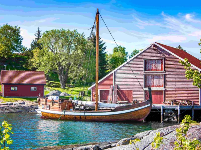
Reuse is not a modern day concept. In the past, when a boat was no longer sea worthy, the wood was resued as building materials on land. Boat timber found in the walls of boat houses and moorings made it possibe to create a full reconstruction of the Sunmøre sailing boat ‘Anna Olava’. These sailing boats sailed along the coast from the Middle Ages and for many hundred years after. It is said that it is these boats that made it possible for people to live here in Havlandet. They sailed to Bergen with goods such as herring, dried fish, cod liver oil and roe, skins and furs. And came home again loaded with corn, salt, wine, textiles and other goods. This boat was named after Anna Olava who was married to Sivert Olsen, a tradesman on Herøy Farm. She was a housewife at the trading post for 14 years and had responsibility for a large household. She therefore needed many of the goods that the Sunmøre boats came with!
#2
HAVILA VOYAGES
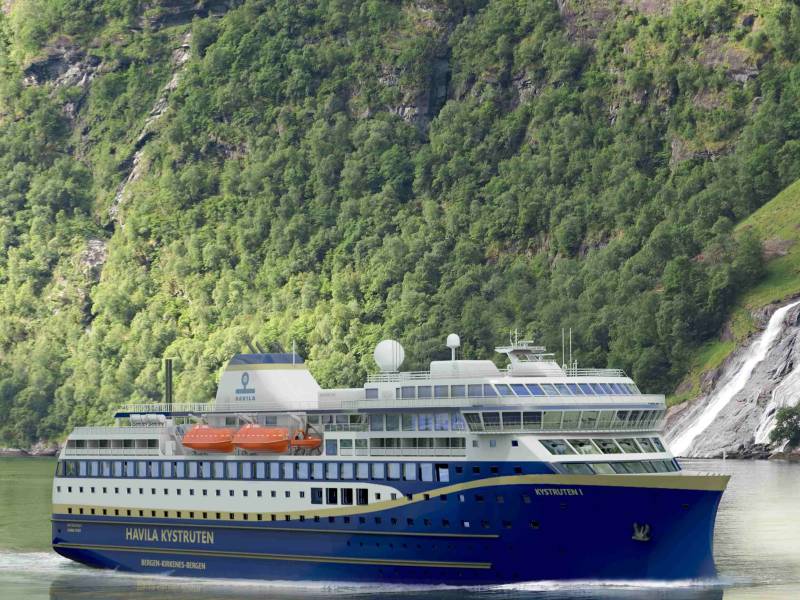
This cruiseliner began with a young man's boat dream in the mid-1950s. Per Sævik earned his first crust at sea, and used it to buy a boat so that he could fish and earn even more money for a new boat. His father and his seven brothers ran a fishery for many decades. In the 1980s, Per Sævik joined the offshore industry, and over time set up several offshore fisheries. He built businesses and communities, and soon his line of work also included ship technology and shipyards. For someone used to steering a boat, the road to ferry operations and passenger freight was short, and Havila Kystruten was born. Since the start of 2021, Havila Kystruten sails four of the eleven traditional routes between Bergen and Kirkenes. The company uses new ships, which are now the most environmentally friendly passenger ships that sail along the coast. As such they are equipped with the world’s largest battery pack.
#3
The Herøy play
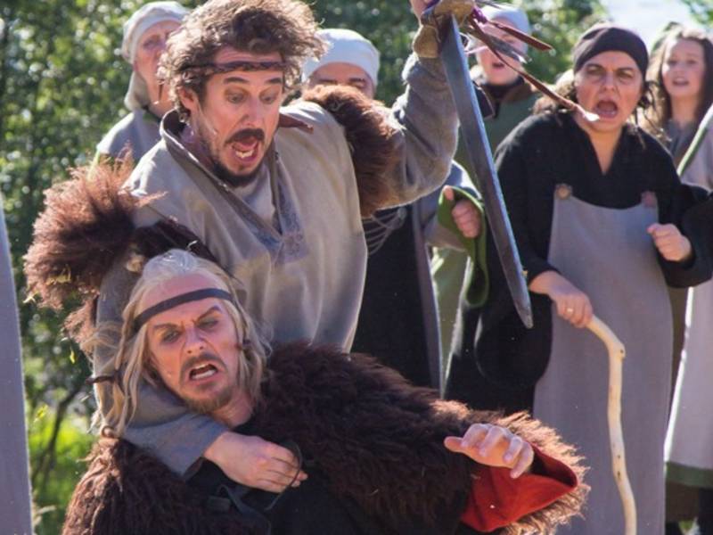
«One of the best historic plays in the country», according to the famous Norwegian actress Agnes Kittelsen after she played the main role in the Herøy play ‘ The King’s Ring’. The play is both theatrical art and the world’s most beautiful Viking musical, but it is also so much more. When 200 actors come together on the stage along with 100 other workers behind the scenes, they form a community that creates magic. The childrens’ sparkling eyes when they get to be a part of the performance, and join the community, is golden for the public and also for the future. Snorre first told the story in his Royal Sagas. But since 1992 ‘ The King’s Ring’ has been performed here on the first weekend in July. An orchestra with 17 musicians and a large choir amplify the action with music. The actors, both adults and children, amateurs and professionals, bring to life the magic of the ‘play by the sea’. And the audience are captivated year after year by the story of the Chief’s daughter Unna who is caught up in a choice between following her heart and choosing the charming Viking rebel Møre-Karl or following tradition and choosing the suitor that her parents had picked. Each of the men had their own entourage and there were battles and strife, then Saint Olav arrived to keep the peace in Havland. The play is set on the island of Herøy with its powerful sea backdrop and where the Lord is the Master of the light. Before and after the play, people gather to eat and talk at the Herøy Coastal Museum just as the people of Herøy have done for hundreds of years. There is a Viking camp for the children, cultural walks, and outdoor church services.
#4
Inner Herøy Church
Not many people know that the Norwegian Seaman’s Mission, or the Norwegian Church abroad, began its work in Tjørvåg in Herøy in Sunnmøre. Sevrine Klungsøyr visited Bergen in the summer of 1864 and discovered that there was a need for a Norwegian Seaman’s Mission. Sevrine was quick to act, and when she returned home, women gathered for the very first meeting of the Norwegian Seaman’s Mission, before the organisation was officially founded. With her husband and five sons at sea, Sevrine knew all about what it meant to have her loved ones absent – and what it meant to lose them. Three of her sons died at sea. Outside Inner Herøy Church is a memorial to Sevrine Klungsøyr. Another memorial has been erected to commemorate the sea as a hard master and the tragedy in the Arctic Ocean. 79 people from Troms and Sunnmøre died when seven fishing ships sunk in Vestisen in a violent hurricane in 1952. One of the ships was MS Pels from Tjørvåg. The ships went down, and the entire crew disappeared. The church also has a monument dedicated to those who gave their lives for their country in World War II.
#5
MULEVIKA BAY
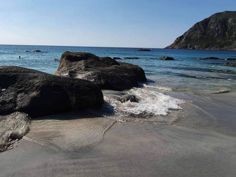
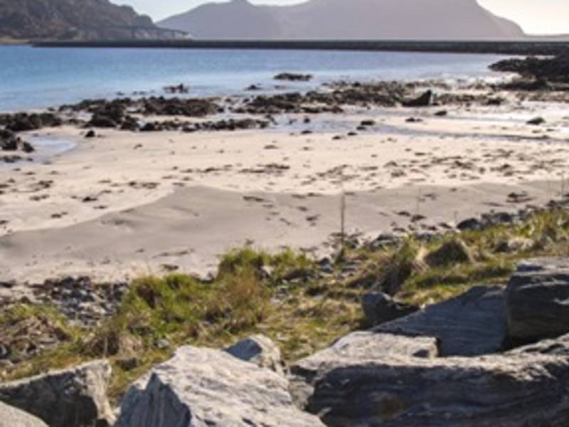
This is a favourite spot for locals. A few minutes’ walk from where the road ends is a long walk to the Atlantic, along wild, rugged shingle beaches. Mulevika is on the left side. During the windy winter months, there may only be shingle here, but then all of a sudden the sea throws up large quantities of sand, and you'll find vast stretches of sand throughout the fjord and seabed. The white sandy plains are punctuated by giant black rocks that rise a couple of metres into the air, great for children and families to explore – and with plenty of soft, natural sand underneath to fall on. Further along the shore you'll find great climbing areas with multiple routes to choose from, and with difficulty levels ranging from three to eight. In the summer, people rush to Mulevika to enjoy the sandy beaches and turquoise seas– even though the water temperature rarely goes above 15 degrees. The sunset on the long horizon is magical, and a night spent in a tent on the sand with the lighthouse flashing in the distance is an experience you won't forget.
#6
THE BRIDGE TO NERLANDSØY
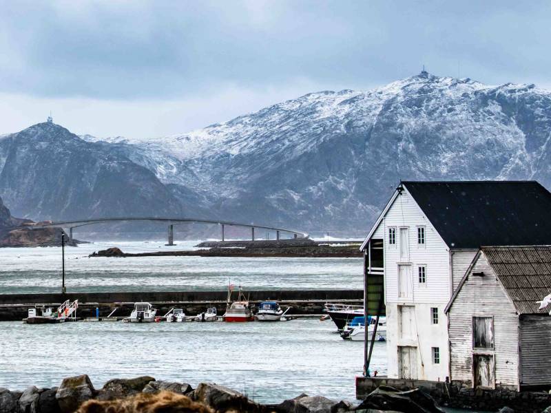
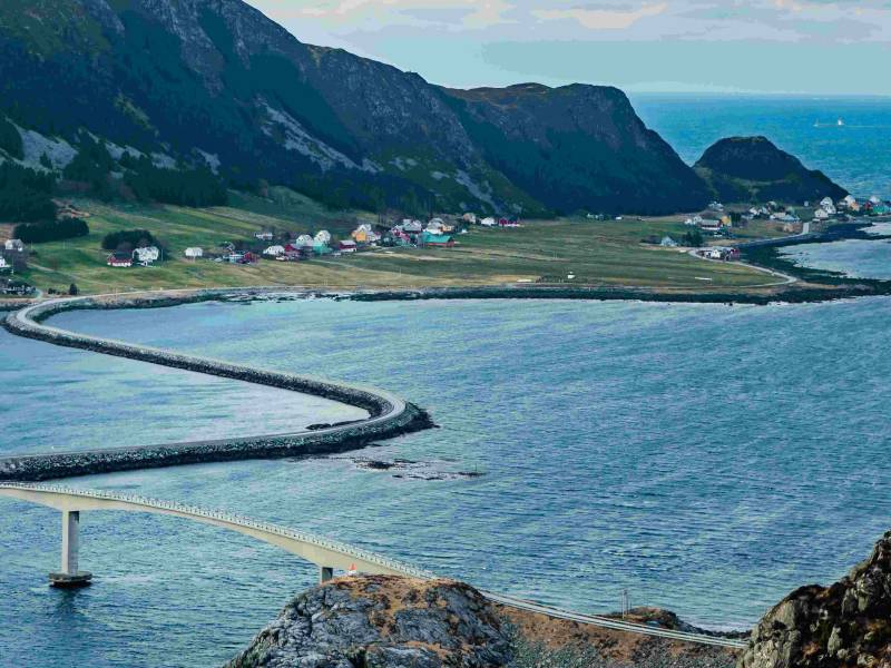
Storm at Stad. Frequently used words in the local weather report. The seaside outside of Stadlandet is renowned for being rough and stormy, and Nerlandsøybrua gives you a great view right of Stadhavet. This also means that the storms run into the bridge. You may feel your car shaking, and quite a number of ski lifts have been ripped away by the wind. It was because of the wind that the bridge had to be rebuilt. An autumn storm took the foundations, and later in the winter, brought them down again, but in September 1968 the bridge was finally rebuilt. On 25 September, both Nerlandsøybrua and Remøybrua were officially opened, the latter of which lies a little further north. The bridges also marked the start of a new era for the islanders. They were finally landlocked and the time of needing a boat to get from the island was over. The boat route between the islands was a much-loved and social meeting place, but it was cumbersome. By using the bridge and cars, everything became easier and the bridges brought people together in new and different ways.
#7
ROSKARRISTINGA CARVING
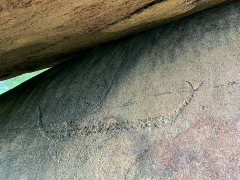
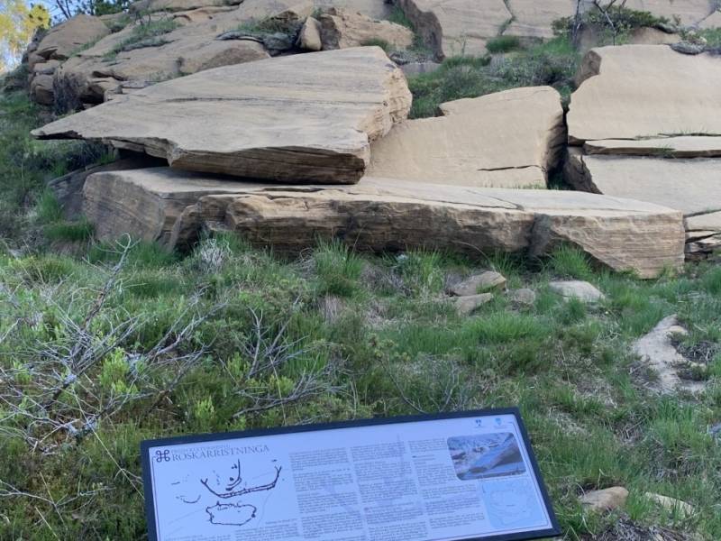
The people of Herøy and Havlandet have always been used to travelling by boat. The approximately two thousand-year-old Roskar Ship is proof of this. In the middle of the dark grey stone lies a brown-orange rock and some archaeologists believe it could have been a mountain. This is because the rock has the only carvings we know of in Sunnmøre, and carvings were usually made on sacred mountains. Perhaps it was a holy place, where a ship transported the dead to the other side. Or the place that the people of the sea are known to dream about. A half-metre-long boat has been hammered into the rock. At one time or another in the centuries around the birth of Christ, a predecessor to the many skilled ship designers in Havlandet sat and carved a ship on this rock. It has beautiful lines, a split frame and a proud guide on board. We don't know what course the boat was going on, but we recognise the longing to embark.
#8
THE ISLAND OF SKORPA
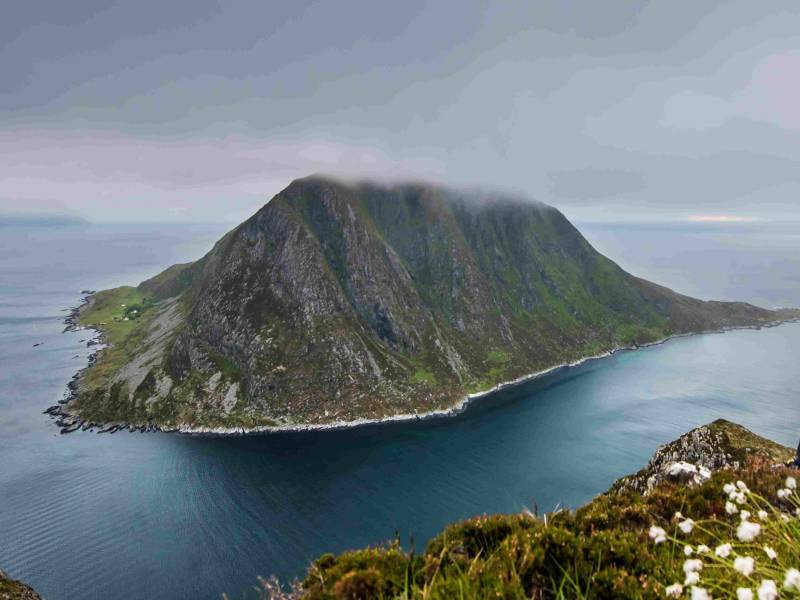
Skorpa is the island furthest west of Havlandet. Steep mountainsides rise out of the sea. Those who lived here, clung to a small surface of land on the inner side of the island. In the 1950’s, around thirty people lived on the island. The people of Skorpa were experienced in both the land and the sea and as such were both skilled farmers and salmon and lobster fishermen. With the boat as a life-saving vessel and the main mode of transport, it is perhaps not surprising that they were also skilled boat builders. From the end of the 1950’s and right through until 1970, when the island became uninhabited, plastic boats were built on Skorpa as a small industrial venture. Now the only permanent residents on the island are coastal goats. These are wild goats and direct descendants of the first goats used in livestock. There are only a few hundred of these in Norway, and most of them are in Skorpa. They keep to the steep mountainsides, but may descend to the fjords for food. With their long horns, they are quite a sight to behold, reminiscent of the ragged Alpine ibex.
#9
SKOTHOLMEN
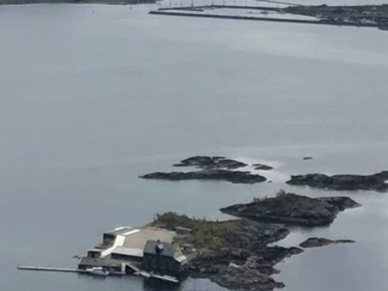
Fishing is a big part of Skotholmen. Fishing and weapons. Over the years, this area has gone from being peasant land to rich man's land. But fishing has always been a major part of the area. There are no less than five fish reception centres and smokehouses. There is salted herring and dried fish. People in Herøy havland often talk about when they were younger and worked on Skotholmen where they would turn the stockfish that was spread out over the large plateaus. Today, Skotholmen is an islet with plenty of tasty dishes to offer. It boasts an open fish restaurant with a varied menu and a catch of the day.
#10
SUNNMØRSBADET WATER PARK
If you want something done, ask a woman. This was the case with Sunnmørsbadet. Today, 6,400 square metres of pure bathing joy awaits anyone who wants to swim, play in the lake or relax and let the warm water nurture sore muscles and joints. Sunnmørsbadet boasts a diving tower and 25-metre pool, wave pools, hot pools and paddling pools, jacuzzi, saunas and steam baths. Every year, Sunnmørsbadet is visited by 100,000 children and young people, adults and the elderly, who don't usually have access to such wonderful bathing facilities.
#11
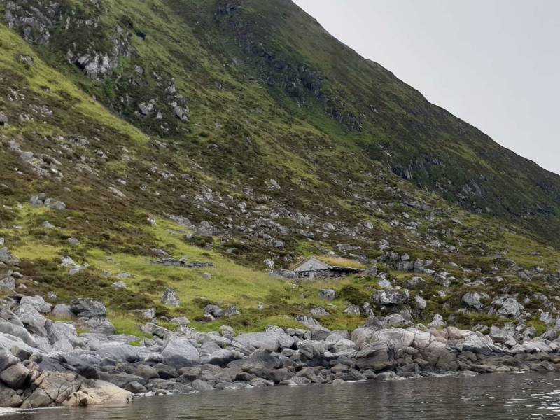
VÅRFJØSEN
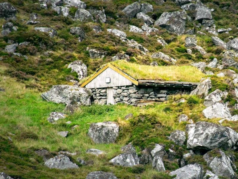
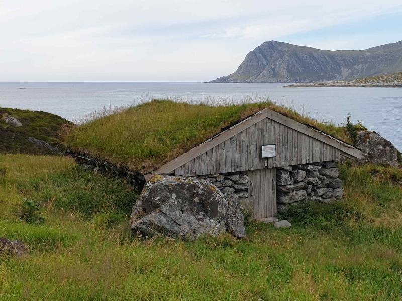
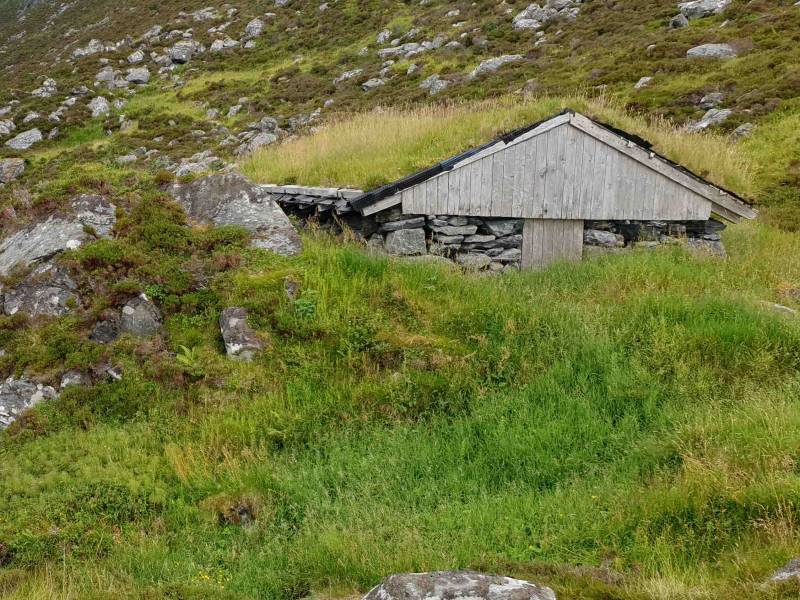
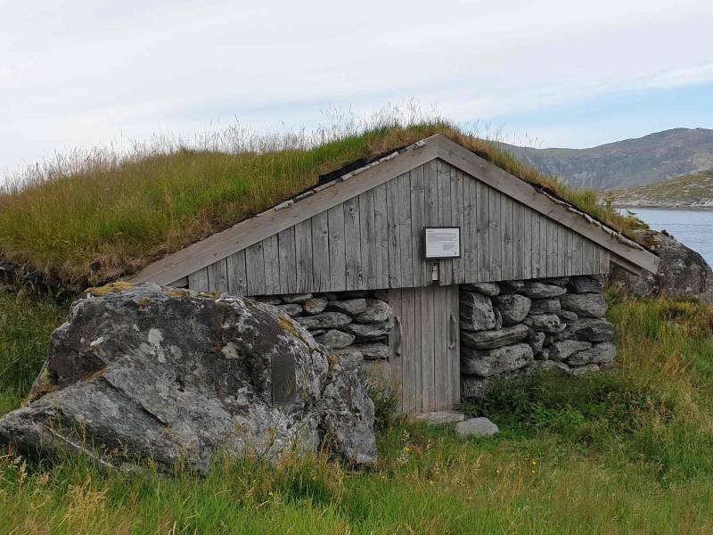
With grey wood walls and a wild grass roof, the spring stable is a natural creation. During the Second World War, it served as a set-off point for illegal traffic across the North Sea. Thanks to islanders whose hearts were in the right place, Skorpa was one of the few places along the coast that could be used during the entire war. Many waited in the spring barn for a crossing to England. Intelligence people and fugitives received food and help from the people on Skorpa. During busy times, there could be twenty or so people in the small stable, and the waiting time could be several days or weeks. One of the most famous people who sought shelter here in Skorpesundet was Shetlands-Larsen and his crew. They arrived following bombings further north up the coast. Eventually, those who were most active in the resistance work had to escape to England themselves. Two of them were declared dead and a death certificate was issued so that the Germans wouldn't keep looking for them. The stable remains a commorative building to the courage and willingness to do the right thing.
#12
THE PREHISTORIC CEMETERY AT LØSETSTRANDA
Close to the magnificent and fiery sunset, with an uninterrupted view of the ocean and easily visible to all those who crossed the sea. Can you imagine a better final resting place? Large excavations by the sea are a special mark for this coastline, and one of the largest of these is Løsetstranda with 63 burial cairns. No excavation findings have been made in the graves. The oldest graves at Løsetstranda date from the bronze age. The tradition of monumental graves came from Greece and returned in the Iron Age. Back then the burial cairns were lower and had more shape. The oldest burial cairns at Løsetstranda may be from the 1700s BC, with the most recent dating from 1050 AC. This means that the burial cairns at Løsetstranda were built in a period of time stretching over 2000-3000 years. The sea has always been an attraction.
#13
LEIKONG ILLUMINATED TRAIL
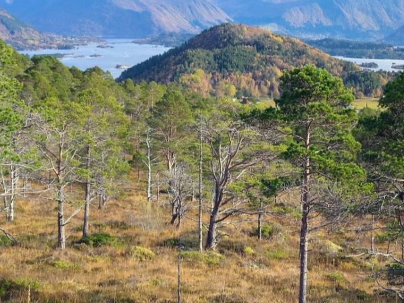
It began with a dream of snow and ski trails in Havlandet. Stable snow conditions are not something that the islands at the far end of the coast are known for and and the Leikong volunteers understood that if they were to secure a ski trail, they would have to have a well-planned route for the snow to settle in. So they began with an illuminated trail. 2.7 kilometres, with 60 light points in multiple loops, so you can vary and extend your route as required. Snow came – and people came. The trail was much sought after by skiers. But the bonus that the volunteers hadn't thought of was that the ski trail was also a great hiking trail when there was no snow. The trail is therefore very busy all year round, with a good gravel road both to walk on cycle on. Some take the trail at a steady pace, others amble and enjoy a break and a coffee stop at one of the rest areas along the way. The trail runs through light terrain and partly through the ancient pine forest. This gives a whole other experience compared to the open and heather-clad areas further out in Havlandet.
#14
HEID HIKING PATH - HORNSETEN
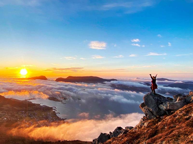
The city mountain in Fosnavåg is of modest height but gives you a 360-degree panoramic view of Fosnavåg city centre, the sea and the Sunmøre Alps – not to mention the best sunsets. One side of the mountain requires proper hiking gear to manage the sheer climb, while the other side can easily be managed in normal footwear at a gentle pace. The path is wide and gravelly and is also well suited for prams and pushchairs, so you can enjoy both a family walk with a break in a lean-to along the trail, or an extended fitness hike, making use of the fitness equipment along the way. The detour to the top of Hornseten is a popular route. You'll only be 190 metres above sea level, but you'll feel like you're on top of the world. Send a warm thank you to Peder, Bjørg and Ingvald who were the first to start working on the trail and open up the city mountain for people to explore. A skilled team of volunteers continued their work and went on to build their own trail. A great trail for both children and adults, which you can take at your preferred pace and in either your best shoes or a pair of trainers.
#15
HERØY CULTURE CENTRE
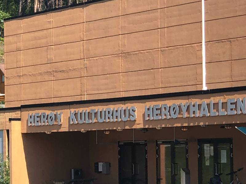
Herøy culture centre and Herøyhallen have been important buildings for Herøy residents for many generations. There were several smaller buildings designed for cultural events and schools sports events in the area, but when the cultural centre was completed in1982 it marked the start of a new era. The cultural centre got a library and culture school in the cellar, and a large cinema with amphitheatre in the main hall. It hosts everything from concerts, revues and performances, to films, fashion shows and public meetings. It is also used for private events, a New Year’s Eve ball and dance. The cultural centre links to Herøyhallen, which has a large cloakroom facility in the cellar, and a handball court on the main floor. School children use the hall during the day, while the various sports associations take over in the afternoons and evenings. In 2014, local residents also got the Fosnavåg Concert Hall, but the cultural centre is still in use, and an important part of cultural life in the municipality.
#16
HERØYBRUA BRIDGE
It’s like an elegant, giant tiara in concrete, soaring high and free through the air. The longest stretch is 170 metres, and with 32 metres of sail height, even large ships can pass underneath. It is this concrete structure that is referred to as Herøybrua, but in folklore the name also refers to the almost 2.5-kilometre long stretch of bridges, rock fills and the road that cuts through islets and reefs. This could be because the this area in itself constitutes a bridge to the inner and outer parts of the municipality, a bridge that meant that the vast majority of the inhabitants had ferry-free movements in between the neighbouring communities. But this particular bridge belongs to a new era. Now we can only reminisce about endless ferry queues, and the old ferry so packed that the cars hung over the edge. And while we're at it, lets not forget the little kiosk with Alf the friendly ticket man who sold us paper tickets, or the local party in 1976, when King Olav opened the bridge, and the helicopter he arrived in made the red carpet float into the sky. But Herøybrua is not there for reminiscing. It marked a crucial step into the future for people in Havlandet.
#17
KVALSUNDSKIPA
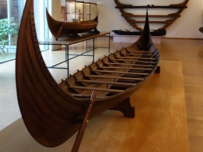
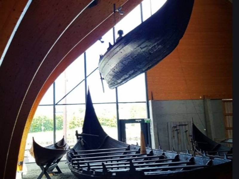
On a summer's day in 1920, a farmer in Kvalsund was working in his fields and discovered wood from a boat in a bog. He realised that there was something special about it and contacted the Bergen Museum. There were excavations in the town and two ships were found. They had been broken up and laid in the ground in what was most likely a sacrifice to the pagan gods The largest ship was 18 metres long, with room for ten pairs of oars. The smallest was almost ten metres long. A replica of each ship has been built, and they are located at the Sunnmøre Museum in Ålesund. Whether these were Viking ships or not has been the subject of much debate. At first people thought that the find was so old that it dated from before the Viking era. Recent accounts indicate that the ship may have been built in the transition between the 700s and 800s, so it is not clear whether those who sailed in the ship were Vikings or not. What is certain is that they were skilled seafarers in Havlandet. The ship is the oldest find with keels in all of Northern Europe. It reflects a time when ships didn't just have oars but also sails.
#18
THE ISLAND FLÅVÆR - TORVHOLMEN
Flåvær is like a little Venice towards Stadhavet, with canals between homes and people, boathouses and houses. For anyone who only uses a car as a means of transport, this row of islets is a specific reminder of a time gone be. Tiny bridges linked some of the islets together, but otherwise transport was by boat. Flåvær is also known as 'Pinebenken' (The Pining Bench). The name refers to a place where boaters would gather to wait impatiently for the good weather to pass over the infamous Stadhavet. And wherever people meet, there's always trade. Flåvær was one of the first settlements in Sunnmøre, and was a trading and hospitality town from the 1600s through to the end of the 1900s. During the busier times, the harbour would be full of boats, and the small islets with their limited number of dwellings would sometimes have up to 1500 people milling around. The largest islet is home to a guest house and a large store. The houses and the facility have been so well taken care of by the owners, that they have received the "Good protection award" from the Society for the Preservation of Ancient Norwegian Monuments. On one of the other islands lies the school, which served the local community for 30 years in the early 20th century and then re-opened for a few years in the 1980s. There was only one student and the teacher went to Flåvær every day. For those who want to experience Flåvær, accommodation is available at Torvholmen in the large main house, which stands as a testament to the island's past life. It is open for event hostings and is a great alternative venue for meetings, and a chance to rent your own island.
#19
SVINØY LIGHTHOUSE
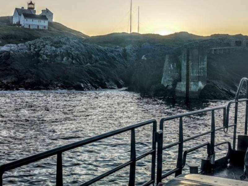
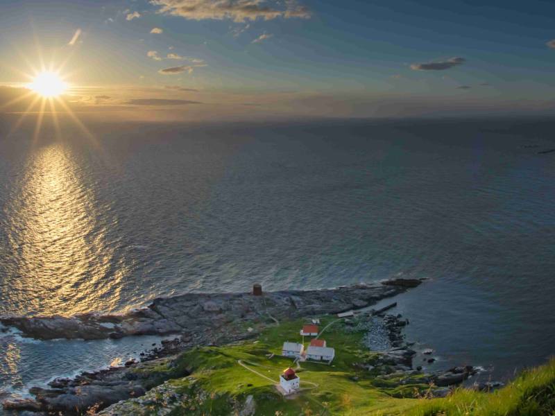
Svinøy Lighthouse is one of the most remote lighthouses along the coast. The wind is particularly strong here, with recorded wind speeds of up to 120 knots, roughly double that of a hurricane. There are no natural harbours or small coves to shelter in, only the cliffs and the endless ocean, which meants boats had to be hoisted ashore. The lighthouse stands 18 metres above sea level. The extreme weather conditions explain why there was no lighthouse in this location before 1905. A lighthouse master and some lighthouse assistants arrived on the island, but they were seldom able to travel to and from the mainland, and had to live alongside the fish and seabirds. They had a couple of cows and goats who competed for the small patch of grass on the island, and otherwise it was seaweed and kelp for dinner. It was a tough life even for the animals, and there are many stories of goats blown out to sea. The first lighthouse worker at Svinøy brought his wife and their seven children with him. A governess would visit to teach the children. It was an isolated life. Mail was delovered only once a fortnight. Apparently they would save the newspapers and keep one to read for each day, which meant they were always a couple of weeks behind the rest of the world. They never knew when they would be able to go on land again. That was down to the weather and the waves to decide. Things got better with the introduction of helicopter traffic in 1970, but it was still the weather gods who had the final say in terms of when the crews could switch over on the island. In 2005, the lighthouse keepers' 100-year service on Svinøya went down in history, and the lighthouse was then automated.
#20
BATHING AREA IN MOLTUSTRANDA
Swimming in Havlandet is not for the faint-hearted. The water is the great Atlantic afterall, and if the temperature ever reaches 17-18 degrees, it makes the local news. But on the other hand, the water is always crystal clear and clean. Little fish splash around in the sea, small crabs scuttle between the rocks, and sandy spots and beaches create stunning turquoise colours, just like in the tropics. Havlandet boasts several fine sandy beaches, in addition to a swimming area with high diving towers in Toftestøda, if you're up for spot of diving - a refreshing experience is guaranteed! On Moltustranda, just behind the school lies Annasanden with views to the south and outwards to Skorpa and the Stadhavet.
#21
BATHING IN HAVLANDET - ON RUNDE ISLAND
Swimming in Havlandet is not for the faint-hearted. The water is the great Atlantic afterall, and if the temperature ever reaches 17-18 degrees, it makes the local news. But on the other hand, the water is always crystal clear and clean. Little fish splash around in the sea, small crabs scuttle between the rocks, and sandy spots and beaches create stunning turquoise colours, just like in the tropics. Havlandet boasts several fine sandy beaches, in addition to a swimming area with high diving towers in Toftestøda, if you're up for spot of diving - a refreshing experience is guaranteed! Rundesanden is easily accessible and right next to the road and bridge on Runde.
#22
SWIMMING IN HAVLANDET - SANDE
Swimming in Havlandet is not for the faint-hearted. The water is the great Atlantic afterall, and if the temperature ever reaches 17-18 degrees, it makes the local news. But on the other hand, the water is always crystal clear and clean. Little fish splash around in the sea, small crabs scuttle between the rocks, and sandy spots and beaches create stunning turquoise colours, just like in the tropics. Havlandet boasts several fine sandy beaches, in addition to a swimming area with high diving towers in Toftestøda, if you're up for spot of diving - a refreshing experience is guaranteed! True to its name, Sande in Bølandet boast a lovely sandy beach.
#23
SWIMMING IN HAVLANDET - MULEVIKA
Swimming in Havlandet is not for the faint-hearted. The water is the great Atlantic afterall, and if the temperature ever reaches 17-18 degrees, it makes the local news. But on the other hand, the water is always crystal clear and clean. Little fish splash around in the sea, small crabs scuttle between the rocks, and sandy spots and beaches create stunning turquoise colours, just like in the tropics. Havlandet boasts several fine sandy beaches, in addition to a swimming area with high diving towers in Toftestøda, if you're up for spot of diving - a refreshing experience is guaranteed! Mulevika is the furthest point by the sea and giant rocks and fine white sandy beaches.
#24
HERØY HISTORY
When the ice retreated after the last great ice age, the outermost islets in Havlandet were the first to emerge. Some people even claim that the ice never settled here. People clung to the narrow strip of land between the ice and the sea, and when the ice melted, it was still only a short distance to the fishing grounds, and a good place to live. On the large beaches between the mountains and the shore you will find traces of people who lived here housands of years ago; bronze knives and stone axes, ships, burial cairns and rock carvings. Farm names also reflect the settlements that stretch back thousands of years. The name of the municipality, Hørei, comes from the small island of Herøy and may refer to the word "hær" (army) revealing that this was probably an army base or meeting point. It may also come from Hørn, a name for the female god Frøya, something that may indicate a cult city for god worship, and again a meeting place. The find of the Kvalsund ship and the line of Viking kings who visited Herøy, indicate a central place along the main road; the shipping lane. And even though the people here ran farms, it was the sea and fishing that fed them and put money in their pockets. 18th century rofessor and naturalist Hans Strøm noted the Herøy people's unwillingness and inability to engage in agriculture. For thousands of years, the people of Herøy hunted the 'blue fields' instead. And this is what life in Havlandet is all about.
#25
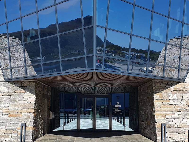
HAVILA STADIUM
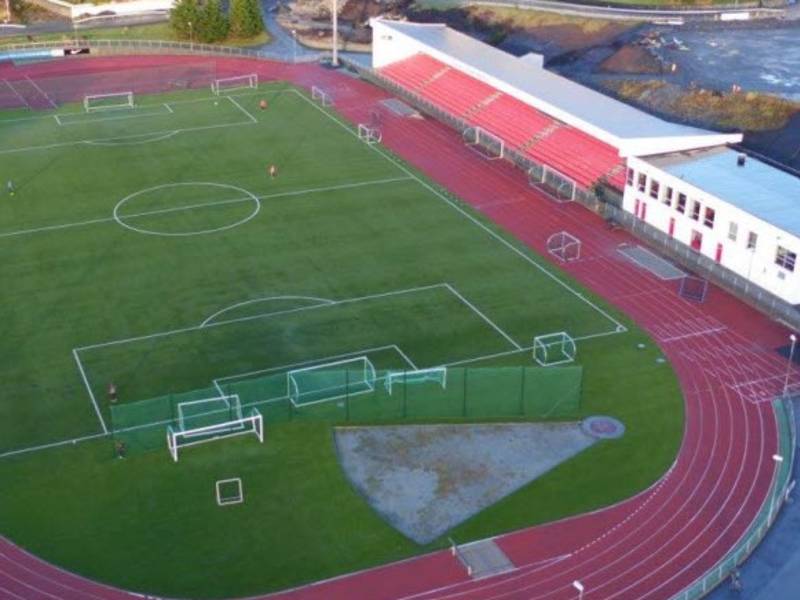
There are many football pitches around Herøy. Some are widely used, and some are new artificial turfs. Others are gravel courts that are unused and have gradually become covered by grass. An important facility in Havlandet is Havila Stadion Fosnavåg, which is centrally located with a school, culture house, Sunnmørsbadet and sports hall. Here, the course itself has been expanded with stadium facilities, a running track, and both a small skate park, tennis court and sand volleyball court. Part of the stadium is also an in-house training ground, where the name of the hall references the history of Havlandet. It is called "Fiskarhallen", as a tribute to the many people who used to splice fish here. Havila Stadion is home to Bergsøy Sports Club. The team still has many fans, even though its heyday was back in the 1970's, and when they rose to the 2nd division in 1980. To be an important part of Sunmøre football with both AaFK and Hødd under its belt, as well as beating Molde Football Club at home is not to be sniffed at.
#26
HAVLANDET`S HARBOURS
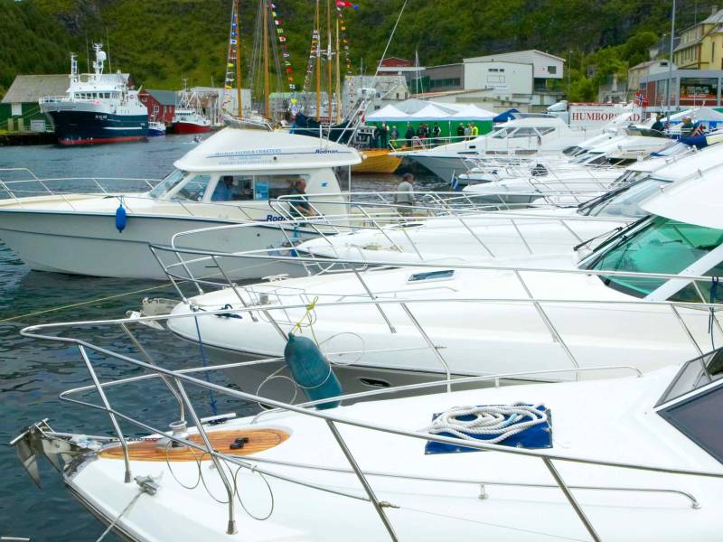
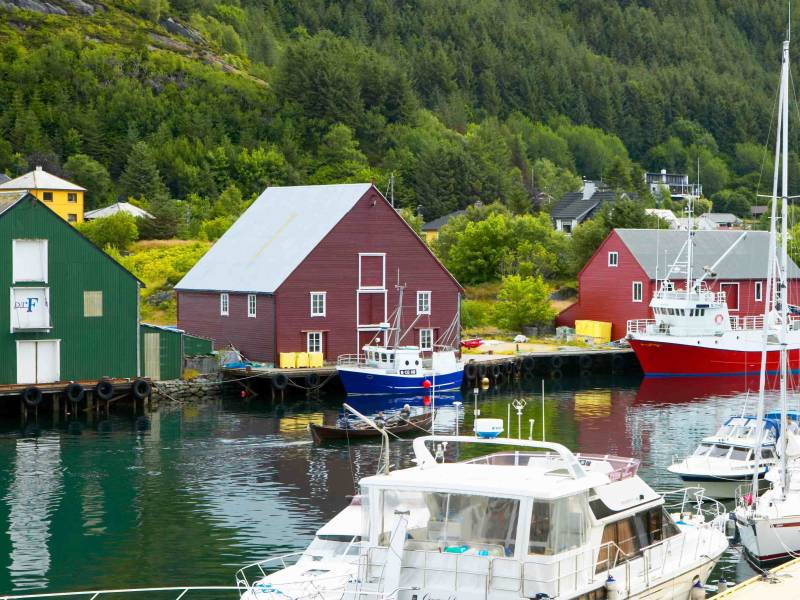
In the old days, they took the boats up to the boathouse, but as the boats got bigger and got an engine, the need for good quays and safe harbours increased. In Kvalsvika, the harbour buildings were like a small industrial facility. There was a forgery, a machinery and cranes, which were operated by steam from coal-fired boilers. An in the early 1900s, the harbour facilities had an exclusive meeting with the railway in the archipelago. The result was a railway that carried stones to the quay, and you can still see traces of this facility at Kvalsvik harbour. Larger boats were also a challenge in the natural harbour of Fosnavåg. The harbour was too shallow, and boats got stuck. In the middle of the harbour was also a reef, which boats constantly hit and got stuck in. Eventually it had to be removed by dynamite, and then Fosnavåg harbour was open to the boat traffic. With so many people with a passion for boating and who earn their income from the sea, there have been big debates about the harbours, their location and the number of boats they need to accommodate. And that is still the case today. Harbour expansion remains a hot topic. But despite the ongoing debates, there are still both small and large harbours in most districts and villages, and of course a myriad of boats, from the smallest leisure boats to the largest fishing boats.
#27
The Vicarage at Stokksund
The island of Herøy was a Church town, but the brutal truth was that the churchyard had so little earth, that the coffins were not buried deep enough. The smell in the summer was downright nasty. And in the end the Priest moved to Raftenes in Stokksund. The vicarage at Raftenes has had several famous occupants. One of them was Magdalene Thorsen. Later, she and her husband moved to Bergen, there Magdalene became a renowned author. She moved in circles where she was surrounded by people such as Bjørnstjerne Bjørnson and Henrik Ibsen. In fact Magdalene was Ibsen’s mother-in-law, and Ibsen’s wife Suzannah also grew up in Herøy. Some have even claimed that meeting the stong fisherwomen of Havlandet inspired Magdelene a great deal, and that it was she who pursuaded Henrik Ibsen to write the suprise ending of «A Doll’s house», when Nora went against her husband Helmer in violation of 19th century etiquette. Maybe it is just a good story, but the fact that Havlandet raised strong and independent women who managed the work and family life on land whilst their husbands were at sea is completely true. Here at the vicarage, Ivar Aasen also came to visit the Thoresen family, to receive teacher training. It is no wonder therefore, that the people of Herøy recognise themselves in the song «Between hills and mountains and out to sea» which has been voted Norway’s second National Song.
#28
Leikanger Church – Leikong
The fjord is long and the church road was tiring, for those who sailed in on open boats with oars and sails. It was therefore preferable to build a church in the home village. This was the case on Leikong beyond the 19th century, and when they heard that a new church was to be built in Ørskog north of Ålesund, the people of Leikong seized the chance. They bought the old church in Ørskog, and moved it with the help of volunteers. Despite the volunteer’s efforts to raise money, it was not cheap to obtain a church. What consultation they took with the Lord is unknown, but the story in the book ‘Churches of Sunmøre’ tells that two fishing crews in the village were very lucky with their herring haul. This earned them great fortune, and the villagers feasted and the money for the church was in place. The church is over 200 years old, a small and beautiful octaganal wooden church with blue walls, colourful paintings, and several tablets and carvings. The Altarpiece is from the 17th century and is a masterpiece of Norwegian art from that time.
#29
The Marble Church on Herøy
Legend tells of three sisters who drifted out to sea, helplessly lost after a shipwreck. They promised that if they made it to land alive, they would build a chuch in the place that they came ashore. One of the sisters made it to Kinn, another to Giske and one to Herøy. These are three places along the coast with churches dating from the early Middle Ages. The building of the marble church on Herøy could have begun as early as the 11th century. The church was devoted to Mary and was built in the same style as churches in England and Ireland. In the middle of the 19th century there was an order from the state that churches should have a designated number of seats according to the population. Therefore, the old church was too small and had to be demolished. The stone was used in the foundation wall of the new church, which was built just a few metres away. It was later moved, and now only the walls remain. Within the walls you can see finely carved marble stones from the church that was built there nearly a thousand years ago. On the site of the old church, the outline of the marble church is marked in slate. The altar is there too with a large stone slab from the marble church as an altarboard. In the middle of the stone there is a depression. That is where the relics were placed. The residents of Herøy have been gathering for church services on the island of Herøy for almost 1000 years. And it was possibly a religious gathering point prior to that also. It was usual to build churches at the ancient Pagan places of worship, and many believe the Goddess Frøya was worshipped here on Herøy before the church was built. Today, Herøy is a key point on the stretch of the coastal pilgrim path that runs from Stavanger from Nidaros and pilgrims can get their pilgrim passport stamped in Havlandet.
#30
Stegleholmen near Herøy
It is almost too strange to be true, but on the small islet next to the island of Herøy, people were beheaded and their heads set high on stakes, to both warn and scare people. The name ‘Stegleholmen’ tells about their barbaric methods. Stegle is another name for a pole, and these poles were used to attach heads to, or to fasten the victims to cartwheels, which they were strapped on to as a form of torture. In Norway public beheadings were the usual method of execution for many hundreds of years. One execution that we know about in Havlandet, took place in the middle of the 17th century. At that time there was a war between Norway-Denmark and Sweden. The Swedish forces withdrew from Sunmøre, but 5 swedish scouts were captured. They were beheaded and their heads set on stakes, most likely at Steglehomen. The last beheading in Herøy took place in 1700. The condemned was a Herøy man who had killed his neighbour’s wife. Again it is most likely that the beheading took place on Stegholmen.
#31
The bust of Bjarne Rabben on Herøy
He did not like to stand out, and the bust of Bjarne Rabben that is on display at Herøy Coastal Museum is not showy either. But the work of Bjarne Rabben is great, and his legacy rich. Rabben was born at Moltustranda on Herøy in 1907. He was a Mason, author and historian. He was the driving force in the Herøy historical association for 36 years, and edited the year book of the association for 50 years. Before he died, he gifted the whole of his local history archive to the historical association, so that the work could continue. He started his career as the travel secretary for IOGT and the Norwegian Total Abstinence Society, and stayed there until he retired. At the same time, he worked diligently on texts and book projects. He published poetry collections, hymns, and other works of fiction. Not to mention the long list of various local history books. Eight volumes of Herøy sagas have been produced and secured for posterity. He published ‘fishing tales’ of Sunmøre and Romsdal in three volumes. Altogether, he has over 30 books in his bibliography, and Rabben received the King’s medal of merit in both silver and gold for his efforts. The people in Havlandet owe Rabben great thanks. Even though he himself had a modest relationship with honour and glory. One of his verses reads like this: When you put high worth in honour, And enjoy the good words, Send thanks to Heaven And keep yourself fixed to the ground
#32
Herøy Coastal Museum
The island of Herøy has been a gathering point in Havlandet for over a thousand years. And this is how the municipality gained its name. Viking Kings arrived here on the small island with their ships. And the Arch-Bishop came here in the 15th century when Herøy was a great church power in Sunmøre. At that time there was a Court House, and people gathered to attend church and to trade here. Then cars arrived and people moved from the coastal roads inland. Herøy Farm was forgotten, and eventually fell into disrepair. The Borgstova which may have been built in the 14th century, was demolished right after the war. Everything was falling down. Just in the nick of time, the historical society in the municipality took hold of the buildings. Now the yard at the old trading centre of Herøy farm is the centre of the Herøy Coastal Museum. The stately farmhouse, the house by the sea, boathouses and stores, kitchen and potato cellars, tell us about the lively trading centre and the households that lived here. The house and interior were taken care of, but as always in Havlandet the boats always held a special place in the heart and were high on the priority list. A Museum boat team both restore and build traditional open wooden boats. These beautiful creations lie moored like jewels at the Coastal Museum. Together with the Sunmøre Sailing boat ‘Anna Olava.’ The island of Herøy invites you on a walk through a thousand years of history. It is well signposted but feel free to take a tour and become better acquainted with the history and people that have lived on Herøy. In addition to the historical walk there are also good opportunities for nature walks both on the tarmacked path that goes over the island and on the adopted nature trail around the island.
#33
Herøy Church
It remains vivid in the memory of those who experienced it. The horror when fire and flames shot up from the roof of the old wooden church. People ran in and out of the church, to try and save the church’s art and whatever else could be salvaged. But those who stood next to the church on that fiery night during the Christmas time of 1998, remember also that the tower of the church dived down in a shower of sparks. Then the people were reminded of the old hymn «The church is an old house, that stands though the towers fall». The church is a building made of living stones, and those living stones set about building a new church house. They raised many millions of kroner from everything from collections and lottery sales to large gifts from private individuals and companies, and just four years after the fire the new Herøy church rose from the ashes. Now you can once again see the church tower rising high over the parish. Inside the tall tower there is a sky light that spills light into the church and it is popular for children and confirmants to challenge themselves by trying thier hand at climbing all the way to the top of the tower.
#34
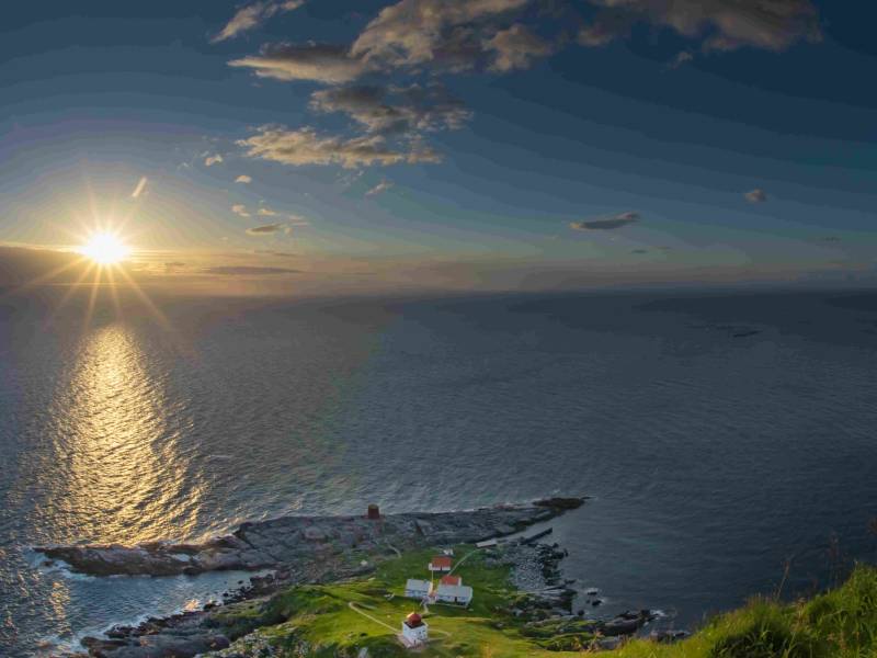
GOLLENESET LIGHTHOUSE
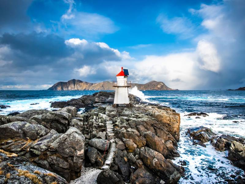
Golleneset lighthouse flashes a welcoming light. The small lighthouse clings to the end of the rain-washed headland. After a short hike on light terrain of just under one kilometre from Kvalsvika, you can enjoy the long shore line and a perfect spot for sunbathing by the sea. But only when the sun is out, because this sea can be fierce and you need to take care on windy days. In Golleneset, you may occasionally experience the sea whipping up foam. Sea foam. It’s like a giant bubble bath with lots of salty bubbles between the rocks and on dry land. The sea has always captured and fascinated people and on your hike out to Golleneset, you'll pass Kjemperøysa, a burial cairn that is estimated to be around 3,500 years old. The name Kjemperøysa (Giant burial cairn), is not so hard to understand. Before they built the pier and harbour in Kvalsvika, there were several smaller cairns by the beach, but the biggest one, the giant one with a diameter of 17 metres, is still there and is an extra sight to see on your way to Golleneset.
#35
DIVING IN HAVLANDET
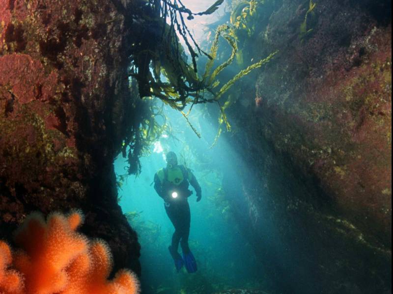
Whether you want to go scuba diving in caves, wreck diving or scuba diving in fantastic, colourful kelp forests, Havlandet offers good and varied diving opportunities. In good weather, you can spend a long time at sea, perhaps hunting for more treasures outside Runde? When the sea is at its calmest, the caves in the colourful bird cliffs at Runde are also worth investigating. If the sea is rough, take a dive trip inwards in the water between the islet and the skerries. Here you can see the giant pots that lie below the sea surface at the island of Herøy. Whether you’re diving far out at sea or closer to the shore, the water is always clear, with good visibility, and you're likely to come across fish and seals. Or how about catching some scallops and catfish for dinner? Several finds are also worth exploring. Perhaps the most famous is Akerendam, which sank off Goksøyra on Runde where the great gold find was made. There are still several canons spread around on the seabed. And of course, it's not certain they got all the coins. Herøy dive club offers plenty of information about dive sites on its website. It's just a matter of diving in!
#36
RUNDE LIGHTHOUSE
Anyone interested in the history of this lighthouse will discover a story involving transport, a state building, work and family life - and of course the weather. Runde Lighthouse is one of the oldest in the country, and the oldest north of Stadt. Bailiff Koren in Kristiansund was a businessman who got permission from the state to buy a farm with some land in Goksøyra on Runde island, so that he could set up a business and manpower to run the lighthouse. And the business was the lighthouse – literally speaking. Back in 1767, the lighthouse was simply a pot with fire in it. The 200-300-kilo iron pot was fired up with peat and coal. The light was natural enough, but when the state took over in the 1800s, the lighthouse was given an upgrade. A lot of people were needed to keep the lighthouse running, so the lighthouse keeper had both a lighthouse manager and a lighthouse assistant. And the men happily brought their families with them, so that at Runde Lighthouse there were both lighthouse managers, their wives, children, servicemen and governesses. A small mini-community of several townhouses and workhouses was built towards the great ocean. This is where children grew up, the love between governess Ingeborg and Martinus blossomed, and where a ten-year-old lost his life on the bird cliff. The forces of nature are powerful this far out by the sea. The last lighthouse keeper experienced a winter storm so strong that it lifted a huge barge far up onto dry land. Runde Lighthouse was upgraded and moved four times. In 2002, the lighthouse was automated and the area was depopulated. Today Runde Lighthouse is a popular DNT-cabin that you can spend the night in.
#37
MOUNTAIN HIKES IN HAVLANDET
When it comes to mountains in Havlandet, there are no impressive heights, only impressive views. A short mountain hike rewards you with a fabulous view of the sea, with a horizon so long that you can see the earth curving. Behind you rise the steep Sunnmøre Alps with their sharp peaks. You can walk over heather-clad heaths right out to the sea – or you can walk over larger plains, and up to 661 metres in altitude if you stay on Gurskøya, the largest island in Herøy. You can stroll in walking shoes on Heid’s hiking trail over the city mountain in Fosnavåg, or you can find your own trails on one of the many islands. You could also head over to Skorpa and can climb the steep slopes in the company of the wild goats. Or perhaps you'd prefer to sit down with a pair of binoculars to enjoy the rich and diverse bird life. There are those who take on twelve peaks in one day, and collect thousands of metres of altitude, and then there are those who stop for a coffee, lie down in the heather and listen to the gentle buzz of the bumblebees. Whatever type of mountain hiker you are, there's a mountain for you in Havlandet, and views guaranteed to impress. Nettsida morotur.no provides practical tips and good maps for numerous hikes in Herøy.
#38
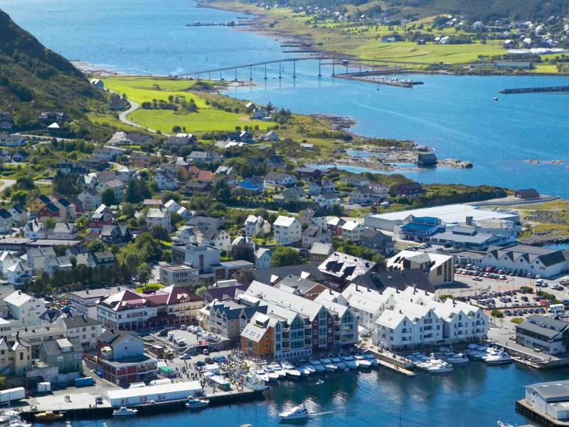
FOSNAVÅG TOWN
Wherever you go, you can't get away from the fact that boats and fishing are the mainstay of Havlandet. This is also the case in the coastal town of Fosnavåg. Even well into the 19th century, there were only a dozen or so houses here with several dozen inhabitants. But during the cod fishing season, there could be over a hundred boats with crews of over 700 men, who found places to live in people's attics and boathouses. Throughout the 20th century, the small coastal town grew, and it remained rooted in fishing and fish processing; herring salting, herring oil and canning, cod steaming, fillet factory and clipfish drying. A cafe, a guest house and fishing homes arrived. The number of shops grew, and one butcher from the 1930s still has descendants today who use the same recipes and who sell meat products and other food in the Meny store in Fosnavåg town centre. Then came the herring boom in the 1950s. There were several thousand men working on land, and so many boats in the harbour, that you could walk across it without getting your feet wet. The activity and value creation was enormous, and the capital and self-confidence that grew gave room for new initiatives when the herring later disappeared. The next big step for Fosnavåg was the oil boom. The fishing boat owners brought their maritime knowledge with them into the offshore industry, and soon there were several listed offshore companies in the small coastal town, enough to secure Fosnavåg the title of best commercial town in Norway. And town, well it's more of a village. On 7 June 2000, Fosnavåg received its town status. The most important thing about this was that the fishing boats could be allowed to paint the Fosnavåg name on their boats next to the boat’s name.
#39
RUNDE`S GOLD TREASURE
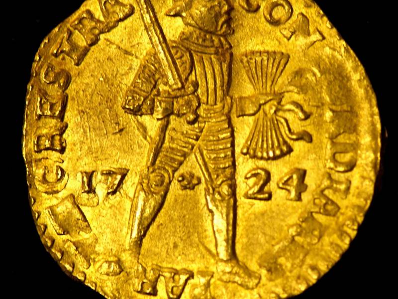
A raging storm rips at the sails. Captain Nicolaas de Roy is unable to rescue the Dutch ship. She was thrown into the mountain wall in Goksøyra on the night between 7 and 8 March 1725. All 200 people on board drowned. Crew, officers – and their wives. Two tons of gold and silver stored in nineteen chests were swallowed up by the sea. Almost 250 years later, someone knocked on the reception desk of the Sunnmøre Police Station in Ålesund. It was a diver with 75 kilos of coins. The kelp forest and stretches of white sand were once the location of one of the biggest treasure finds in Europe. 57,000 coins were picked up along with canons, bronze vats and embroidery scissors, pipes, silver forks and belt buckles. Many of the coins were sold, and the treasures were stored at the Bergen Maritime Museum, before rather symbolically being once again transported by boat back to Runde and the Runde Environment Centre. Here, people can see the gold coins, weapons and tools, decorations and splendour from the Akerendam trading ship . Many people long to find more wrecks on the seabed in Havlandet. There's a story of a ship, “The Invincible Castle” from the Spanish Armada, which is supposed to have sunk near Goksøyra at the end of the 1500s. It is believed that this vessel was also carrying great wealth. Even if you don't find any treasure, diving in this area of clear water and exploring the kelp forest is still an incredible experience.
#40
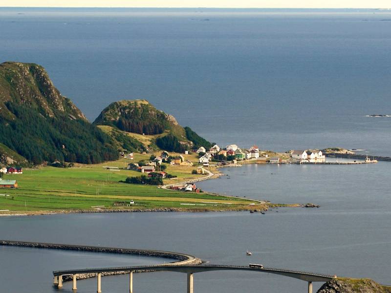
RUNDEBRUA BRIDGE
Herøy is the bridge municipality. Ten bridges link the islands in the municipality together, and the king of the bridges is Rundebrua, which is right by the ocean. Once the wind was so strong here that it turned over a lorry. Fortunately the railings stopped the lorry from going any further and the lorry driver survived. Sometimes the sea fills the road with rocks and water. As you cross, look out for the small holes at the bottom of the side walls, which serve as outlets for the sea when there is flooding. Sundet under Rundebrua are good fishing spots, and you rarely see fishermen at the top of the bridge. If you happen to get a catch, you can only hope that the fish has latched on well because you'll need to carry it twenty metres back up.
#41
REMØYBRUA BRIDGE
A jetboat used to sail a fixed route between the islands, transporting people, mail and goods. Many had their own motorboat or rowing boat. The car went on to change people's habits and caused the islanders to rethink their lives. Even before the Second World War, the islanders had wanted to build bridges between the islands. But it would take a while, and it wasn't until March 1967 that you could drive across Remøybrua bridge. It was a long-awaited moment. Several people on Remøya had cars before the bridge arrived, despite the fact that they could only drive on the two kilometres of gravel road on the island. In September of the following year, there was an official joint opening together with Nerlandsøybrua, the twin bridge a little further south
#42
PUFFINS AT BIRD ISLAND RUNDE
“Rrrrhhhrr, arrhhrr”. You could be forgiven for thinking that it was a flock of chainsaws making its way across the sky, but it's only the puffin colony. In spring, puffins come in from the sea to mate, nest and hatch. Mating is brief, as puffins stay with the same partner throughout their entire lives. And they can live up to 40 years old. After a winter out at sea, the puffin nests back in the same nesting spot; holes and paths that they dig in areas of up to two metres into the mountains. This is where the female lays her eggs, but both birds take turns to keep the nest warm. Mum and dad share the incubating and fetching of food. With their jagged tongue and beak, they can easily capture ten wrigling fish to bring back to the nest. Puffins with up to sixty fish in their beaks are a common sight. And it's the beak with its bright yellow, orange and blue-brown stripes that have made this bird so popular and given it the name of sea parrot. In Lundeura on Runde island, you can get close enough to touch the female puffin, who has more than just good looks to offer. The puffin is one of the few birds that stands upright. It is about as tall as an A4 sheet of paper. These small wings can flap 300-400 times per minute and give the bird a top speed of almost 90 kilometres per hour. And it’s even better at keening. Puffins spend much of their life at sea. This is where they can breathe and dive as deep as 60 metres. But despite its strength and speed, puffins are on the red list and a vulnerable species. There are tens of thousands of puffins in Runde mountain during nesting season, but that’s less than half of what there used to be. You are visiting a beautiful and rare creature. Give her peace and quiet to gather food and to feed her baby.
#43
Grasøyane fyr
På ei øy som er så langt ute i havet at ho har fått namn etter graset som greier å vekse der ligg Grasøyane fyr. Her kom det fyr i 1886 og saman med fyrtårnet er det både uthus, naust og fyrvaktarbustad. Fyrvaktarane hadde med familien sin og ein av dei som vaks opp der ute seier at ein betre barndom kunne ein ikkje ha. Men einsamt, ansvarsfullt og langt til havs var det for dei som var vaksne. Kommunikasjon kunne vere vanskeleg, og det var avtalt med folk i land at dersom dei såg at det var hengt ut eit stort svart, tøystykke på husveggen der ute på Grasøya, så trengdest det hjelp. Etter krigen fekk fyrvaktarane turnus og hadde ikkje lenger med seg med seg familien på fyret. I 1986 vart fyret automatisert og avfolka. I dag er det fuglane og selane som regjerer på Grasøya. Øyane rundt fyret er ein del av Runde naturreservat. Her er ein selkoloni med både steinkobbe og havert. Dei er mange og dei kan ligge både i fjøresteinane og kome nysgjerrig symjande rundt båten din. Husk at du er ein gjest på besøk i deira heim, og både fugl og sel treng ro og avstand. Jakt, fangst og øydeleggingar av alle slag er sjølvsagt forbode. Dei som kjem etter deg skal også få oppleve og glede seg over dyre- og fuglelivet.
#44
THE BIRD CLIFF ON RUNDE ISLAND
The bird cliff rises 300 metres from the sea. It is the third largest and southernmost bird cliff in Norway, with 230 registered species and 500,000 birds. But numbers can never replace the experience of lying completely still in a boat while watching the dizzying and bustling bird life above you - or sitting on the edge of the cliff and looking down at them all. The northern gannet soars through the air looking for prey, olds its 1.5 metre+ wingspan and forms itself into a torpedo that plunges towards the sea's surface at a speed that can reach 100 kilometres per hour. Seagulls cry above you and bird droppings have stained the entire mountainside white. And if the weather is good, you can sail into the cave, which is like a quiet bubble in the sloping mountainside, full of magical colours and just the echo of your voice. As you leave the cave, look out for the sea eagles. Kings of the air and the largest bird of prey in Northern Europe. There are plenty of sea eagles around Runde and you'll be able to see a whole flock of them at once. The eagle has a wingspan of around 2.5 metres - in other words it's gigantic. Having them fly around you is a real experience. Whether you're here by boat or on foot, keep your distance and take care The birds need their peace and space. You are only visiting.
#45
GERHARD VOLDNES
When the potent smell of herring oil settled over Fosnavåg, people said that "it smelt of money". People had to protect their laundry from the smell, but when the herring oil lubricated the entire economy, suddenly the smell didn't matter so much. It was the smell of money afterall. Fosnavåg was Gerhard Voldnes' home town, and he established a herring oil factory, a herring saltery and a shipyard here. The shipyard delivered the very first Norwegian-built supply boat to a Norwegian shipyard, which made part of the Norwegian oil adventure. During the abundant herring years of the 1950s, up to 1,000 employees were employed at Voldnesanlegga in Fosnavåg. The large houses at the very heart of Fosnavåg are still standing. The brick office building is an architectural gem, where the Gerhard Voldnes office is as it was during his heyday, with all the furniture and fittings still intact. The safe is so big that you can actually enter it.
#46
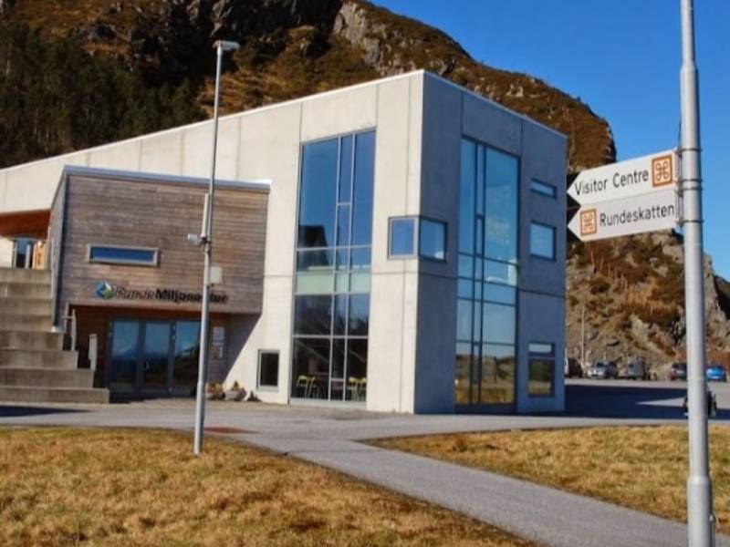
RUNDE ENVIRONMENT CENTRE
Local fishermen know the ocean like the back of their hand. When this knowledge meets the research environment, exciting things start to happen. And that’s probably the idea behind Runde Environment Centre. The goal of the Environmental Centre is to raise more awareness about Mørefeltet, a key maritime area outside Runde. It is known as the rainforest of the sea and is one of the largest biological processes on the planet. This is an important breeding area for herring, cod and other species that live in the sea. One percent of all fish that are fished in the world are born outside Runde, and the herring roe that lies beyond the seabed here has a weight of two to three times the entire population of Norway. Runde Environment Centre is an international environmental research station, a communication centre and a location used for courses, seminars and conferences. Visitors include researchers, tourists and locals who want to see the exhibition about the Runde treasure, the rich collection of seabirds, or learn more about the Mørefeltet, the ocean’s rain forest.